A 2-year study of atmospheric chemistry over vast Amazonia juxtaposes pristine and polluted environments
The Amazon River pours more water into the ocean than any other: 20 percent of the riverine discharge in the world, which fans into an Atlantic Ocean estuary 240 kilometers wide. The Amazon is also the second longest river on the globe, intersecting the broad head of South America like a hatband 6,259 kilometers long.

There is more to the bigness of the Amazon, which is so expansive that it has been called “the river sea.” Its drainage basin, spangled with more than 1,100 tributaries, spans 40 percent of South America. That vastness makes Amazonia, the basin of more than 7 million square kilometers, “a giant biogeochemical reactor” that influences regional climate, according to a summary of Green Ocean Amazon (GoAmazon2014/15), a recent U.S. Department of Energy field campaign coordinated by the Atmospheric Radiation Measurement (ARM) Climate Research Facility.
In January of 2014, a binational team of researchers set out on a 2-year field campaign to investigate how manmade pollution affects (and will likely further affect in the future) the natural atmospheric chemistry of Amazonia forest cover and the particle microphysics of the same region. GoAmazon2014/15 is also a 3-year project funded by the DOE’s Atmospheric System Research Program. Twenty scientific investigators from the United States and Brazil are involved, along with a binational consortium of universities and government agencies. While the 2-year field campaign wrapped up last December, enough data were collect to inspire years of published studies.
Two “high profile” papers have already come out of the effort, said principal investigator Scot Martin, a professor of environmental chemistry at Harvard University.
Vulnerable Amazonia
The most recent one tracks the fate of isoprene over the central Amazon during the wet season. Isoprene is a biogenic volatile organic compound that, when oxidized by sunlight, heavily influences atmospheric chemistry over forested areas. The paper, with Martin as corresponding author, appeared during the week of May 16, 2016, in the Proceedings of the National Academy of Sciences.
“This paper points out the extreme susceptibility of the natural functioning of Amazonia to increased emissions of pollutants, especially as related to climate,” he said.
In a further sign of the experiment’s scientific richness, a special issue of the journal Atmospheric Chemistry and Physics has so far published six articles on GoAmazon2014/15. The special issue is “live,” said Martin, and is open for another 3 years.
In all, GoAmazon2014/15 was a long-term observations and modeling experiment that focused on a complex set of interactions. The scientists asked how vegetation, atmospheric chemistry, and aerosol production intersect with aerosols, clouds, and precipitation. They wanted to understand and quantify how these processes worked under natural conditions (as a baseline) and how they were affected by human activities.
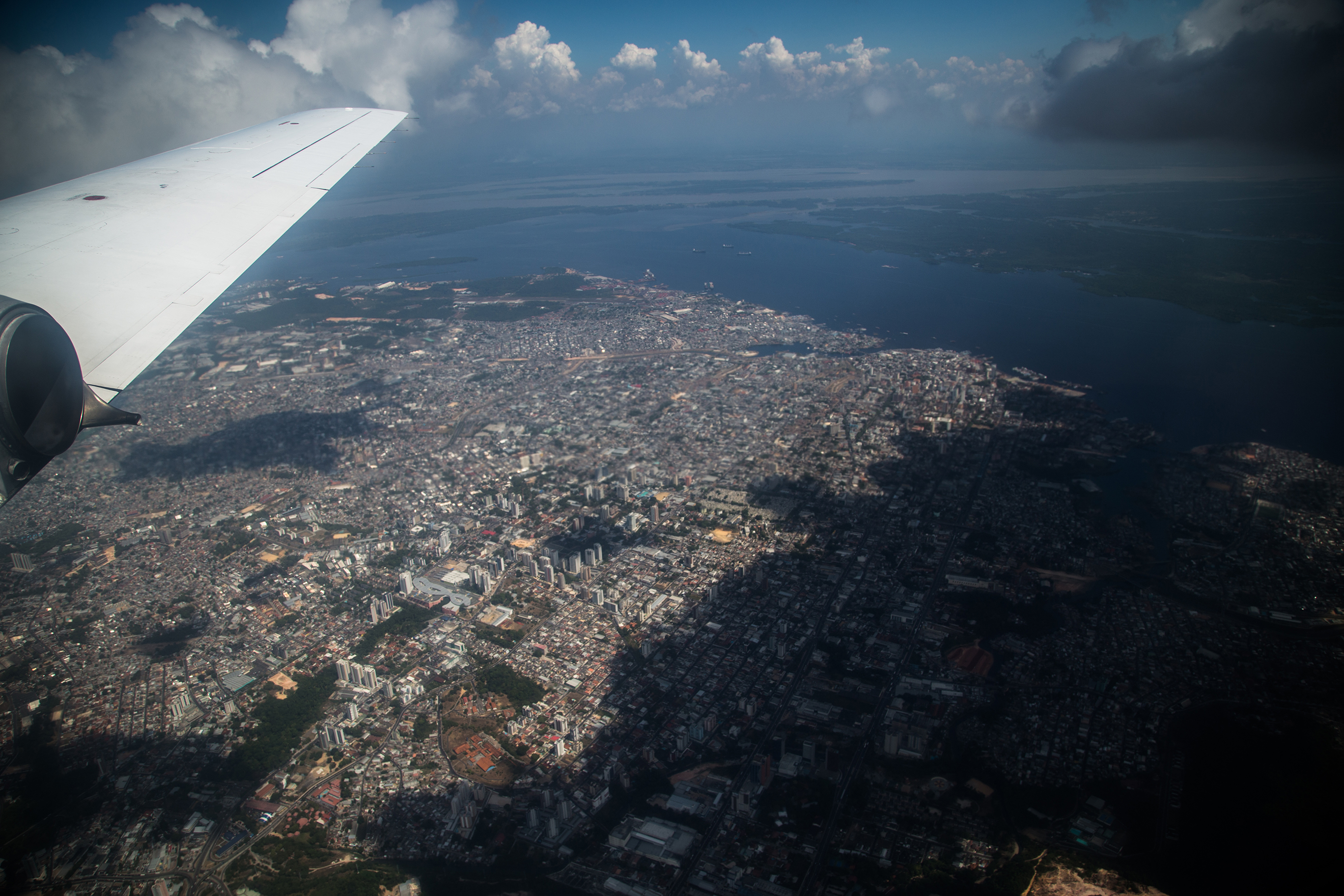
Martin called this intersection of climate influences a “natural laboratory” for studying the Amazon’s atmosphere, its realities, and its challenges. The experiment’s urban center was Manaus, Brazil, a city of 2 million that sends into the air an all-season plume of pollution from its oil-burning energy plants, vehicle exhaust, and industrial sources.
A String of Instrument Sites
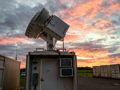
During data collection, three air-sampling research sites were situated upwind, downwind, and within Manaus. A fourth was the main ARM instrumentation site, or ARM Mobile Facility, situated in a farm pasture 70 kilometers outside the Manaus.
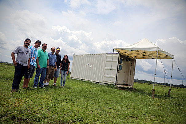
It was there that Martin set up the first of 15 20-foot by 10-foot containers bristling with DOE instrumentation. (Eventually, more than a hundred instruments were in place at the rural site.)
Soon, 14 other similar instrument clusters were set up across the research region in advance of the campaign’s two “intensive observation periods,” or IOPs, in 2014: February to March (the wet season) and August to October (the dry season). During these times, as many as 50 scientists and technicians were busy in the field.
Early on, results from the research were presented at a May 2015 GoAmazon conference at Harvard; 37 presentations used data collected up until then. Among the revelations were that lightning strikes are a hundred times more likely inside the Manaus pollution plume than outside of it.
Catching Data, Testing Tools
Overall, GoAmazon has two goals: The first is to create a database for Amazonia that archives flows of energy, carbon, and chemicals in a signature tropical rain forest. (Many data sets are already publicly available on the ARM website.)
“No other data set like this one has been collected before,” said Martin last year. The second is to establish computer modeling tools with predictive value: models that can estimate likely future changes: in radiative forcing (how much energy from sunlight is either absorbed by the Earth or radiated back into space); in regional climate; in feedbacks to global climate systems; and in likely future changes to ecosystem functions.
GoAmazon’s data-collection period is over, and the ARM Mobile Facility has been packed up and shipped to Ascension Island for the 17-month Layered Atlantic Smoke Interactions with Clouds (LASIC) field study.
But there is a “next,” said Martin: an investigation of urban pollution sources in Manaus, which will include a network of air quality sensors in the city and the deployment of data-gathering unmanned aerial aircraft.
Highlighting and measuring air pollution in Manaus, Martin added, will be part of Brazil’s Smart City Projects. In place already are urban enhancement projects in Rio de Janeiro (integrated operation centers for weather prediction, security, and traffic flow); in Sao Paulo (the Detecta video surveillance system); and in smaller cities (digitizing urban center and e-government platforms).
For more information, see the research highlight.
This work was supported by the U.S. Department of Energy’s Office of Science, through the Biological and Environmental Research program as part of the Atmospheric System Research program.