A young scientist presses for improvements in radar retrievals of snowfall properties, cloud microphysics, and more.
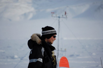
In early January 2009, German meteorology undergraduate Maximilian Maahn began a six-month semester abroad at the University Centre in Svalbard, Norway. During the winter months, this mountainous archipelago in the Arctic Ocean—just 650 miles from the North Pole—is pitch-dark 24 hours a day.
To see where he was, says Maahn, “I had to wait for a full moon.”
Two weeks after arriving, he finally viewed the surrounding terrain: conical mountains streaked with snow, steep valleys, and cliffs that butt against frozen-over ocean bays. Behind the student housing, a glacier doubled as a ski slope.
This frigidly exotic place “sparked my passion for polar regions,” says Maahn.
“A model has a thousand knobs you can turn. It’s hard to correlate all these knobs with the thing you can observe in the atmosphere. We need to connect these two worlds.”
—Maximilian Maahn
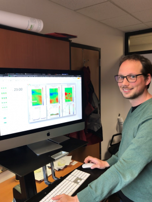
Today, he is a research scientist with the Cooperative Institute for Research in Environmental Sciences (CIRES) at the University of Colorado, Boulder, which is affiliated with the National Oceanic and Atmospheric Administration’s (NOAA) Earth System Research Laboratory (ESRL).
A decade after his sojourn in Svalbard, Maahn is an energetic fixture in the Polar Observations and Processes team, part of ESRL’s Physical Sciences Division. He works on advanced modes of remote sensing. The focus is on radar observations and retrievals as well as cloud and precipitation processes.
A lot of his data comes from an entity that Maahn says “profoundly influenced my academic and professional life,” and which he first encountered as an undergraduate in Germany: the U.S. Department of Energy’s (DOE) Atmospheric Radiation Measurement (ARM) user facility.
Robust, continuous data of the ARM kind are critical. In models designed to predict Earth’s future climate, the biggest uncertainties relate to clouds and precipitation.
“I study them with measurements,” says Maahn, “try to improve those measurements, and use the results to explain processes. With this understanding, you can improve models.”
Into the Field
Improving the predictive acuity of earth system models and understanding the atmospheric processes that inform them are at the heart of the Atmospheric System Research (ASR) program at DOE, which has funded some of Maahn’s recent work.
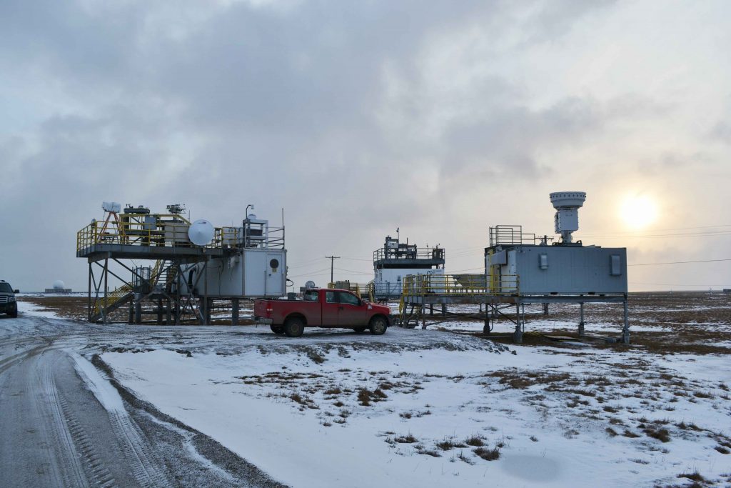
He is part of a CIRES-NOAA northern Alaska science team led by University of Colorado research scientist Gijs de Boer. The team uses radar, radiosondes, and other sources of data from ARM’s North Slope of Alaska atmospheric observatory, as well as from the DOE-funded Oliktok Point site. Both are operated by Sandia National Laboratories and used jointly by NOAA and International Arctic Systems for Observing the Atmosphere.
Northern Alaska is “a natural lab,” says Maahn, where researchers can study atmospheric collisions between relatively pristine polar air and industrial emissions. (At Oliktok Point, for one, Prudhoe Bay Oil Field is nearby.)
Oliktok Point combines measurements from ground-based instruments and from a 40-mile-wide, 700-mile-long airspace out over the Arctic Ocean. De Boer and others have used part of the airspace for data retrievals using unmanned aerial systems, balloons, and instrumented kite systems.
In part, the northern Alaska science team is using its ASR funding to understand the impact of dramatically fluctuating sea ice on the atmosphere.
Maahn and others are “investigating aerosols, retrieving snowfall properties, and modeling mixed-phase clouds,” he says.
The team’s main ASR project investigates ways to better understand the arctic atmosphere and its fundamental processes in the face of rapidly evolving conditions. So far, they have done more than 10 papers; among them is a look at the effects of local pollution on cloud properties, a study led by Maahn.
More studies are underway, including one on calibrating ARM radars in Alaska, now under public review. Maahn is the lead author.
Last year, in June 2018, the arctic science team presented a poster on model evaluation efforts at the annual Joint ARM User Facility/ASR Principal Investigators Meeting. It was based largely on measurements made at Oliktok. Maahn was one author, along with colleagues from NOAA, CIRES, ESRL, and Brookhaven National Laboratory.
This year, in a June 2019 reprise of the same meeting, the group will present three posters on northern Alaska science: on their cloud and precipitation microphysical studies, including the results of a new processing algorithm; on developments in datastreams and instrument quality, including a look at technologies developed to prevent ice formation on radiometers; and an overview of recent measurement activities using tethered balloon systems.
In earlier related work, Maahn cowrote a 2012 paper on a Micro Rain Radar processing scheme—his first work as a lead author—on how to improve the characterization of snowfall. With co-author and veteran radar expert Pavlos Kollias, he proposed an improved processing method especially suited for snow observations.
Two later papers took an arctic turn—one on ice cloud observations (2015) and another on improved radar retrievals of cloud microphysics (2017).
A First for ‘Measuring Stuff’
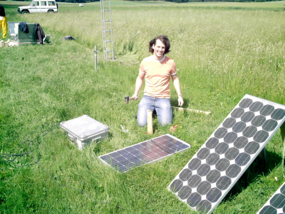
In 2007, while doing fieldwork with classmates at the University of Bonn, Maahn encountered scientists in Germany’s Black Forest during ARM’s Convective and Orographically-induced Precipitation Study (COPS), a field campaign designed to study precipitation from atmospheric uplift.
For a student contribution to COPS, he took up a job managing a precipitation counter—an important moment in his emerging identity as a scientist.
“This was the first time I got involved in measuring stuff,” says Maahn.
He went on to receive the German equivalent of a dual bachelor’s and master’s degree at the University of Bonn in 2010.
Later, as a first-year doctoral student at the University of Cologne in Germany (PhD, 2015), Maahn traveled to ARM’s Southern Great Plains atmospheric observatory. There he oversaw a German radiometer during the Midlatitude Continental Convective Clouds Experiment (MC3E), a 2011 ARM-NASA field campaign investigating convective processes.
Maahn’s PhD dissertation—a study, in part, of improved radar retrievals for measuring ice clouds—relied on data from another instance of ARM fieldwork: the Indirect and Semi-Direct Aerosol Campaign (ISDAC) in 2008.
ISDAC collected ground and airborne data at ARM’s North Slope of Alaska observatory.
‘All the Checkboxes’
The future will be even more data-rich and thrilling for polar research, says Maahn, who outlined his science plans and dreams.
He says “one of the most exciting things coming up” is the Multidisciplinary Drifting Observatory for the Study of Arctic Climate (MOSAiC).
Slated to run from September 2019 through October 2020, the international arctic science campaign is funded by DOE, NOAA, NASA, the National Science Foundation, and many international agencies.
The co-coordinating scientist for MOSAiC, Matthew Shupe—whose CIRES office is across the hallway from Maahn’s—says it will be the largest atmospheric exploration of the central Arctic ever.
In September, an instrumented research icebreaker will push out into the Arctic Ocean from Tromsø, Norway, park in a remnant ice flow, then drift westward for 12 months, collecting data all the way.
“If it works out as it’s supposed to, MOSAiC has the potential (to generate) one of the most complete, exciting data sets for the next decade,” says Maahn. “From a radar perspective, there is everything you can imagine. All the checkboxes are marked.”
Half of his time goes to the Polar Observations and Processes group led by de Boer. The other half—just recently—goes to a project headed by arctic research colleague Amy Solomon that’s about “tapping into the modeling business to better understand the needs of modeling people,” says Maahn.
That’s another dream of his—combining modeling and observations into an integrated framework.
“A model has a thousand knobs you can turn,” he says. “It’s hard to correlate all these knobs with the thing you can observe in the atmosphere. We need to connect these two worlds.”
Getting There
Not long ago, Maahn ran into his childhood nanny. “Oh,” he recalls her saying. “I always knew you would be a scientist!”
Early on, he had an affinity for math and physics. In his undergraduate years, atmospheric microphysics was the draw, along with radar systems where insight comes from complex, mathematically intriguing spectra of data points that tilt in wave-like curves.
Moving to the University of Cologne for his PhD work, he joined the Integrated Remote Sensing group—“a perfect match” of personalities, “vibe,” and funding, says Maahn.
He worked with polar researcher, mentor, and dissertation advisor Ulrich Löhnert, who steered him to ARM’s ISDAC data.
Atmospheric science turned out to be an appealing path to pursue physics in an appealingly practical way.
At first, “I was afraid physics would be too far from reality,” says Maahn. “You have to have a relation to the subject you are studying.”
# # #
This work was supported by the U.S. Department of Energy’s Office of Science, Office of Biological and Environmental Research as part of the Atmospheric System Research Program.