One scientist takes a journey from oil painting to cold-air pools, wildfires, and how pulses of surface air help make clouds
How hot air rises.
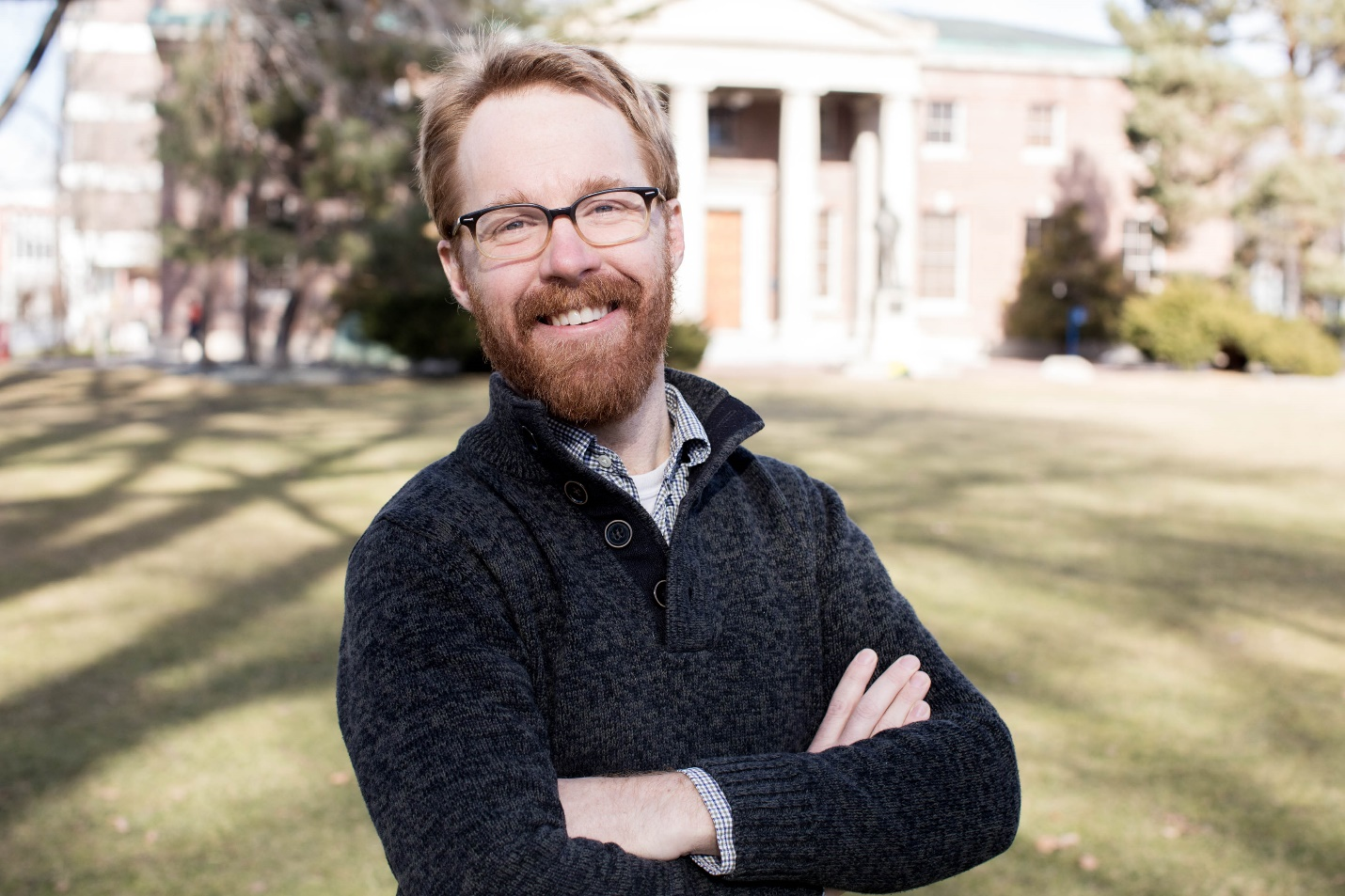
For most of us, that’s a fair summary of research by Neil Lareau, an assistant professor at the University of Nevada, Reno.
Of course, he would add a few details, including on a project Lareau has underway for the Atmospheric System Research (ASR) program at the U.S. Department of Energy (DOE).
He was awarded ASR funding in the fall of 2017 to investigate how heat, moisture, and momentum rise up from Earth’s surface, pass through the atmospheric boundary layer, and go on to initiate clouds.
The work involves both shallow fair-weather cumulus clouds and the deep-convective type that drop rain and snow.
The idea is based on observations, says Lareau, and will “quantify how all those processes play out―in particular the updrafts.”
Global-scale climate models and even high-resolution weather models reflect only the bulk properties of such updrafts.
That means such models do not explicitly represent what’s going on. But the ASR investigation, he says, “can paint a really complete picture of how these updrafts go on to initiate clouds.”
“I can’t say enough about how well ARM lubricates the wheels of doing science. Their data sets are so well curated and available.”
Scientists have not had that capacity in the past, adds Lareau, “but now it’s possible to leverage the latest technology to inform what has been a difficult physical problem.”
Breaking through the Lid
Lareau says it is important to capture the evolution of these updrafts exactly.
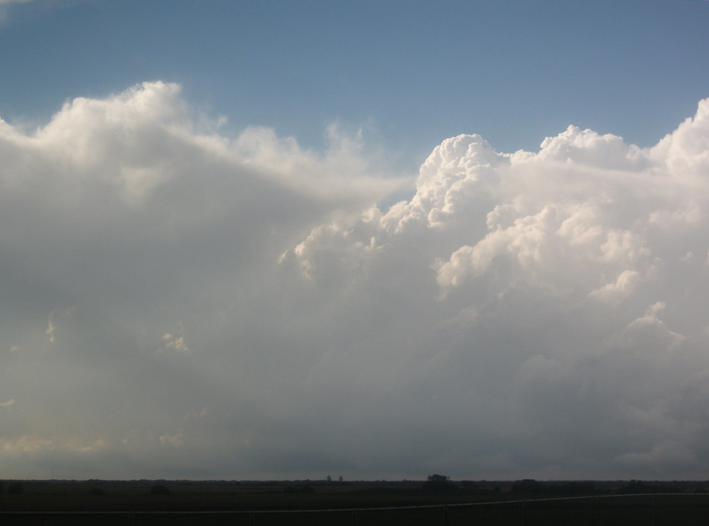
For one, these pulses of heat and moisture from the Earth’s surface are an important clue to how clouds are formed. They also influence how big clouds get and whether or not they result in precipitation.
Lareau explains that there is a kind of lid―an energy barrier―in the lower part of the atmosphere. It has to be perforated by updrafts to move air from the surface to the altitudes at which clouds are initiated.
Such updrafts, bulging with moisture and accelerating as they ascend, have to be strong enough to rise high enough in the atmosphere that the moisture gets cold enough to form a cloud.
Once conditions are cool enough, water vapor is forced to form a cloud, says Lareau. “Every fluffy little cloud that we see out there is in some way connected to one of these updrafts rising from the surface.”
‘The Water Part’
Several papers related to the ASR project are in the works, Lareau says, but two key studies have already appeared.
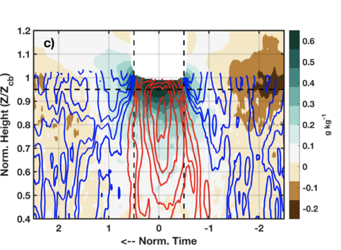
The first, published in June 2018, was tied in part to research he had done earlier at San Jose State University and Lawrence Livermore National Laboratory. It reported on boundary layer controls on clouds by looking at updraft properties derived from Doppler lidar.
The second, published in March 2020, and wholly tied to ASR-funded research, looks at those same updraft properties, but with the added context of water vapor.
Lareau used lidar data to see how much water vapor was contained in the updrafts and how that water vapor was being transported up to the cloud base to initiate a cloud.
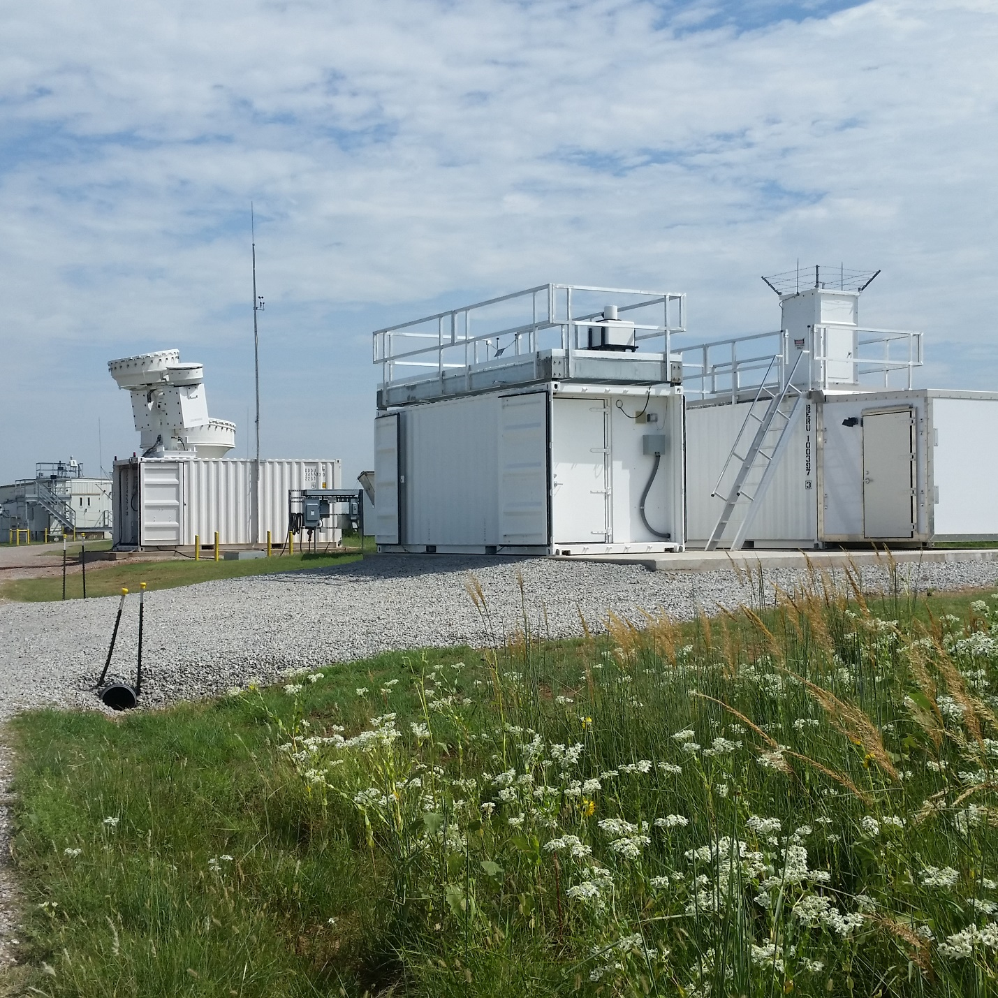
Data from both lidar systems came from the Southern Great Plains (SGP) atmospheric observatory, the largest and oldest fixed site operated by the DOE’s Atmospheric Radiation Measurement (ARM) user facility.
“What we were able to do by combining these two different datastreams is really quite novel,” says Lareau. “We could look at both the velocity part and the water part.”
Access to measurements from networked lidars gave his work a big lift.
“I can’t say enough about how well ARM lubricates the wheels of doing science,” says Lareau. “Their data sets are so well curated and available.”
Delving into Process
For the ASR project, Lareau is fully utilizing the students working with him at the University of Nevada, Reno.
Master’s degree student Brandon Daub, who presented a poster on the ASR research at the 2019 American Geophysical Union Fall Meeting, is looking at how updrafts interact with the energy barriers. He is comparing the data on days that produce shallow clouds to those that produce deep clouds. (The former clouds are rain-free; the latter produce precipitation.)
PhD student Courtney Keene is delving deep into the process details on how updrafts evolve as a function of height.
That includes investigating the updraft properties of outflow boundaries, which occur at the leading edge of locally strong updrafts. And Keene is studying how the width and speed of thermal updrafts change as they rise higher.
Wildfire Synergies
Beyond his research for ASR, Lareau investigates wildfires, including the updrafts they engender and the clouds and weather they make.
Earlier papers he coauthored have looked at cold smoke in 2015 (“cold-smoke” air currents are induced by wildfires), pyrocumulus clouds in 2016, and turbulence in wildfire convective plumes in 2017.
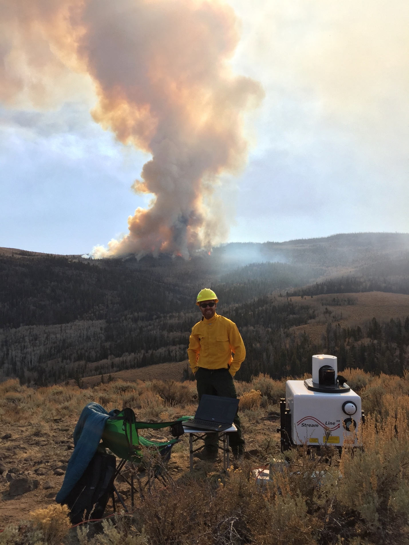
Lareau says wildfires present “very exciting opportunities to use modern observational tools to look at things people had not looked at before.”
Trained up and in full protective gear, he has pointed lidar at fires from as little as 1 kilometer (0.6 miles) away, or from the relative safety of “in the black,” which describes an area already burned over.
Lareau helped write a 2018 study of the Rapid Deployments to Wildfires Experiment (RaDFIRE), a 2013-2016 field campaign in the western United States that used Doppler lidar and other instruments to peer into 21 large-scale blazes.
“There’s a clear overlap in the work,” he says of his dual fascination with updrafts for DOE and his wildfire work, which is funded largely by the National Science Foundation. “It’s really the exact same question.”
Hot Air Rising
The crux of that question is buoyant convection: how hot air rises, how updrafts change with height, and how they go on to initiate clouds.
“There’s a tremendous symmetry between the tools,” especially Doppler lidar, says Lareau. “I am often learning things from one analysis to another.”
There is an existential drama to wildfires, he acknowledges, along with more polluted clouds, erratic winds, tornado clouds, and “radically different intensities.”
Fire-induced clouds can create weather that in general is more unpredictable than weather resulting from normal updrafts. During wildfires, updrafts can rocket into the atmosphere at 130 miles per hour (60 meters per second). Ordinary updrafts pulse into the air at 16 mph (8 meters per second).
However, work on the evolution of updrafts for DOE can be just as intellectually captivating as using, let’s say, lidar data you pulled yourself in real time from the edge of a wildfire.
“The data and analysis part is just as interesting, I’ve learned over the years,” says Lareau, who likes the puzzle and surprising complexities of updrafts over flat terrain in Oklahoma, as at SGP. “There’s always something interesting in a problem.”
The Wildfire Business
Studying the atmospheric science of wildfires “was somewhat coincidental,” says Lareau.
It began when he was a postdoctoral researcher at San Jose State University (2014 to 2016), studying fire-induced circulations with mentor Craig Clements, who directs the university’s Fire Weather Research Laboratory.
A second, short-lived postdoc at Lawrence Livermore National Laboratory (2016), looking at cloud processes with Yunyan Zhang, brought Lareau back into the realm of how shallow clouds transition to deep clouds.
For what seemed like another brief moment, he was back in the wildfire business as an assistant professor at San Jose State (2016-2018) before moving on to Nevada.
In all, “I was really building a repertoire of understanding how hot air rises,” says Lareau, whose postdoctoral journeys prepared him for his ASR updraft studies and using ARM measurements. “I was really able to hit the ground running with this amazing (ARM) data set.”
Mountain Weather
Lareau grew up in Granby, Connecticut, which is so heavily wooded that black bear and eastern moose traverse through town.
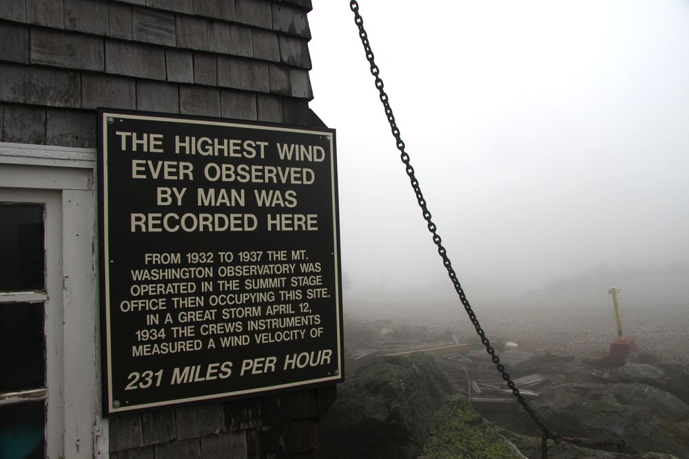
Early on, his family made frequent trips north to the White Mountains of New Hampshire. By age 6, Lareau had hiked up Mount Washington, which in winter can be among the windiest and coldest places on Earth.
He calls mountains and mountain weather “a lifelong hook that goes back literally as long as I can remember. Mountains immerse you in the atmosphere. You hike up into the clouds.”
With a few detours, that lifelong hook pulled him to his present occupation in the most mountainous U.S. state. The University of Nevada, Reno, is near Lake Tahoe, between the Sierra Nevada and Carson mountain ranges.
The biggest detour along the way took Lareau to Pittsburgh, where he studied oil painting at Carnegie Mellon University (B.F.A. 2002).
Art and science both rely on observation, says Lareau. “It’s all about looking―looking at what’s really there.”
Cloud Watcher
After college, Lareau followed his abiding passion for mountain weather, starting with an atmospheric science textbook. He got a job as a gallery attendant at the Andy Warhol Museum in Pittsburgh. In his spare time, he read the book from cover to cover.
During the next four years, as a weather observer at the Mount Washington Observatory, Lareau continued his self-study program while going outside every hour during his shift “in some of the worst weather on Earth,” he says, to record the height and amount and types of clouds. “That gave me a lifelong passion for clouds themselves.”
Lareau moved to Utah with his wife Krysia Skorko, a hydrologist and geomorphologist who now works for Trout Unlimited. (They have two children: 4-year-old Henry and Sylvie, who turns 1 in May.)
He took a year of undergraduate courses in atmospheric sciences at the University of Utah (M.S. 2010, PhD 2014) to prove his academic mettle, and entered the doctoral program in 2008.
“From there,” he says of his journey to science, “the rest is more linear and reasonable.”
Cold-Air Pools
“I arrived in Utah very much wanting to study complex terrain,” says Lareau.
In part, that meant studying atmospheric fluid dynamics and boundary layer processes under the direction of MesoWest director John Horel, an expert in mapping and tracking regional weather.
That association led to Lareau’s master’s thesis, an exploration of storm-track variability over the western United States.
Soon after, he was enmeshed in a deep study of cold-air pools.
For days or weeks in the wintertime, these lake-like masses of dense, cold air sequester in mountain valleys and other down-slope terrain features. They are not only deeply frigid, but they trap air pollutants.
Lareau wrote his dissertation on the fluid dynamics and physical processes of how cold-air pools are eventually fractured and dispersed.
Winds aloft push surge-like waves across those lakes of cold air until they spill out of a basin or valley like water brimming over the side of a pool.
The same onset of strong winds from above scours and thins out cold-air pools until they are just a few meters deep. At that point, sudden bursts of warm wind can penetrate to the ground and finish the job.
Common Threads
All this work on turbulent processes and changes in ground dynamics readied Lareau for the work he does today.
Turbulent thermal and mixing processes near the surface of the Earth, in both violent wildfires and milder updrafts, says Lareau, “have a common thread.”
Another common thread in Lareau’s work is that his connection to fine art remained.
He called “the cool thing with science” the fact that it allows you to see more of the world and its inner ways: painting images, as it were, with sophisticated remote sensors that leverage different parts of the electromagnetic spectrum and that look at infrared and microwave wavelengths.
With science, says Lareau, “you’re extending your eyesight.”
# # #This work was supported by the U.S. Department of Energy’s Office of Science, through the Biological and Environmental Research program as part of the Atmospheric System Research program.