A University of North Dakota severe-weather researcher is making a rare deep study of blowing snow―its place in models and how to describe and measure it
We have all seen and felt blowing snow―stinging needles on bare faces, cannon shots of the white stuff blowing in front of the car.
And we know what it is: not falling snow, with its whole flakes, but the kind blown aloft by local winds so energetically that snowflakes fragment into crystalline shards.
A small number of scientists are interested in blowing snow at bigger scales. Big blankets of it called convective rolls can be a half-mile high and miles wide. The researchers ask: What is the macrophysics of blowing snow―that is, its plume height, frequency, and duration?
What causes it?
How does blowing snow―usually in the air for a half-day or less―affect climate processes like radiative energy and ice-mass balance? How can it be captured in climate-scale models?
And how can blowing snow be incorporated into models?
Questions like these drive recent research by Aaron Kennedy, an associate professor of atmospheric sciences at the University of North Dakota.
He and his research team are mid-way through a project investigating blowing snow and how to detect and characterize it. The work is funded by Atmospheric System Research (ASR) at the U.S. Department of Energy (DOE) and relies on data from another DOE entity, the Atmospheric Radiation Measurement (ARM) user facility.
Blizzard Alley
Kennedy has spent a lifetime captivated by the physics and drama of severe weather.
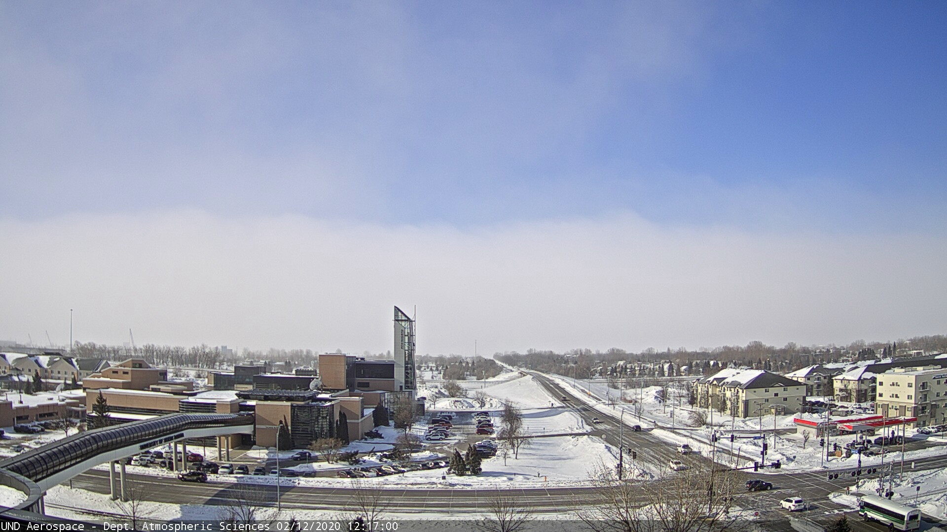
He met his first meteorologist at age 3; as a grade-schooler, he mapped tropical cyclones with his father (then a U.S. Marine Corps search-and-rescue helicopter pilot); and now lives in the Red River Valley, a region of North Dakota and Minnesota with more blizzards every year than anywhere else in the lower 48 U.S. states.
“Meteorologically, we are probably in one of the coolest places in the country for hazardous weather,” Kennedy says, adding that tornadoes and bruising thunderstorms arrive in summer and whipping blizzards in winter. “I love it.”
Forecasting blizzards is challenging, says Kennedy, lead author of two papers on such events in the Red River Valley―one in the May 2019 issue of Climate and another in the April 2020 issue of Monthly Weather Review.
The same is true of blowing snow events. Except for studies mostly done in Antarctica and remote northern Canada, the literature is scant.
AWARE (and More)
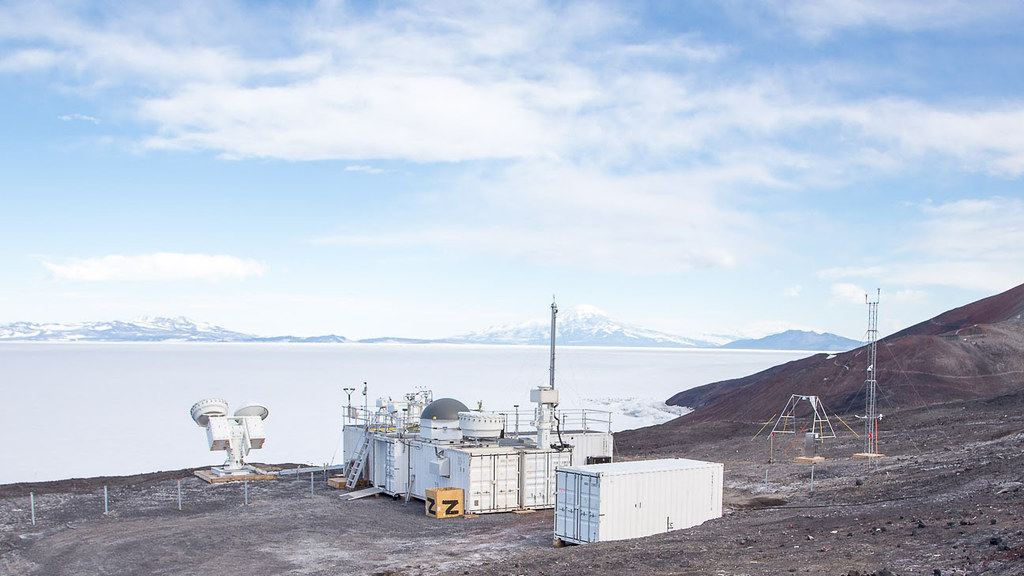
For the ASR project on blowing snow, Kennedy draws on data from the 2015-2017 ARM West Antarctic Radiation Experiment (AWARE); from ARM’s North Slope of Alaska (NSA) atmospheric observatory; and from measurements taken during several to-be-determined deployments of ARM Mobile Facilities.
AWARE, the most advanced atmospheric field study ever done on Earth’s most remote continent, was designed in part to address worries that Antarctic ice masses are shrinking.
“Blowing snow has unknown impact on the climate, including the mass balance of ice sheets,” says Kennedy. “But we don’t know enough yet about how important it is to include in models.”
When current models include snow at all, he says, they assume it falls to the ground and stays there. The dynamics of blowing snow “are not in the models” at all, and there are not that many observations of such systems.”
He and his ASR team are investigating the little-known macrophysics of blowing snow. They want to generate data useful to the ARM and ASR research communities and use the same data to evaluate a blowing-snow model.
Instruments and Algorithms
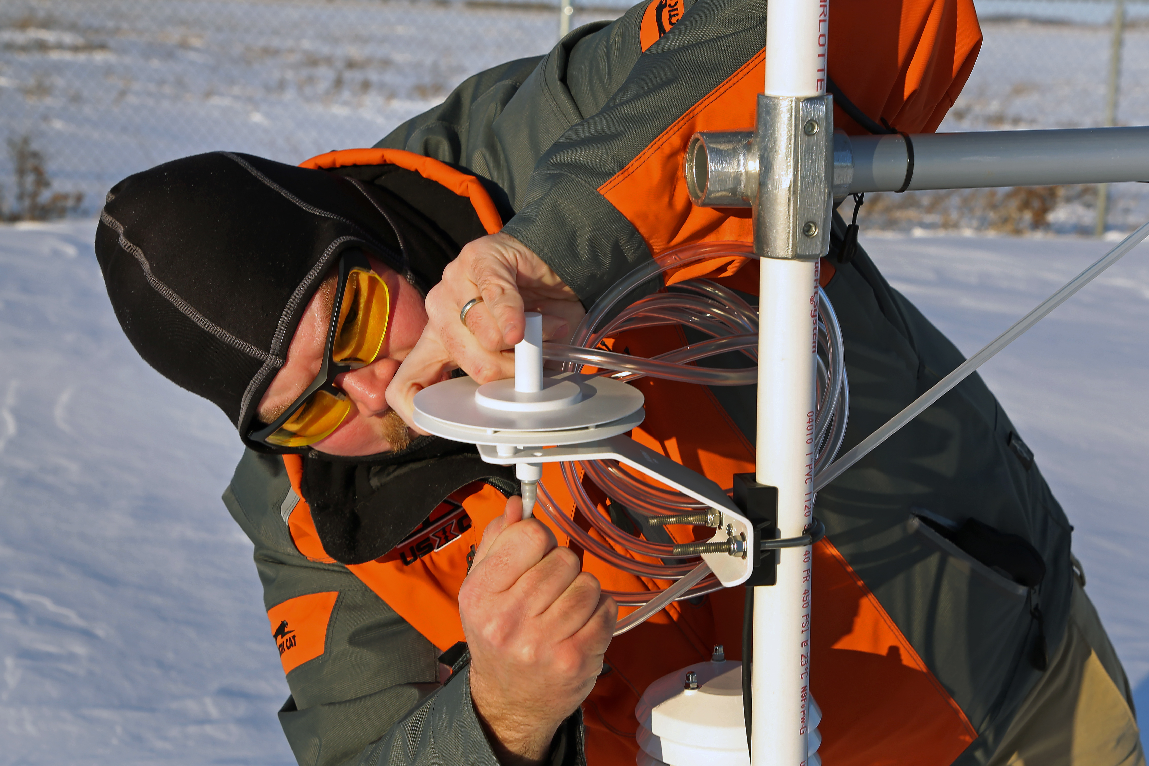
Kennedy is searching for a way to separate data on blowing snow, with its fractured crystals and erratic velocities, from measurements of falling snow. The key is adapting a mathematical algorithm for detecting blowing-snow data from ceilometers.
These ground-based remote sensing instruments, aimed at plumes of blowing snow, measure light scattered back by clouds and precipitation. Combined with data from radar and lidar, these measurements are run through the algorithm to yield insights into how blowing snow impacts the radiation budget.
For studying blowing snow, “the ceilometer is the cornerstone instrument,” says Kennedy.
But backscatter signals from the device are relatively weak, and its measurements of small-particle blowing snow quickly attenuate, he adds―limitations that were “the starting point for developing this algorithm for ASR.”
The machine-learning algorithm, called a Self-Organizing Map, will also classify and analyze weather patterns downloaded from the European Centre for Medium Range Weather Forecasting. This way, the ASR project could answer whether blowing snow is generated locally or from forces outside a given region.
Let the Writing Begin
By May of 2020, Kennedy and his researchers had analyzed most of their AWARE data by using their algorithm to detect blowing snow and compare it to the observations at McMurdo Station, Antarctica. (A first project paper is underway.)
Among other things, the data gave them “a much better estimate of the top of the blowing snow layer,” a key mystery, says Kennedy, that appears to top off in high latitudes at around 500 meters (1,640 feet).
Higher blowing snow altitudes, he adds, seem to be prevalent in lower latitudes.
Next up is analyzing data from ARM’s North Slope of Alaska, as well as work to get blowing snow data into models.
Meanwhile, Kennedy longs for “a dream suite” of AMF-like instruments in North Dakota, which is riven by blizzards and blowing snow worth studying―if only for the societal benefits of being able to forecast disruptive snow phenomena.
Unlike Antarctica, he says of the northern Great Plains, “there are people here.”
‘Built for Snow’
And what hardy people some of them are.
Kennedy often recruits graduate students from Canada and northern New York, where snow and bitter cold are humdrum.
“I’m built for the snow,” he says of himself. “In the winter, you just put more clothes on. It’s an easy problem to solve.”
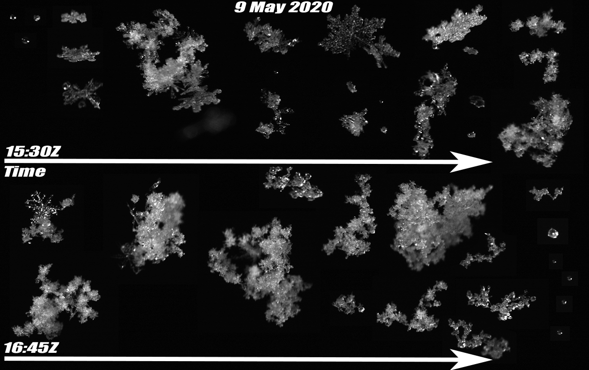
For wintertime fun, he rides a bicycle mounted with studded 4-inch tires and photographs local snowmobile races. Last winter, supported by the National Science Foundation (NSF), Kennedy built a snow cam―a machine-vision camera paired with a high-speed LED strobe. It takes pictures of falling snowflakes.
Kennedy and his students combine ASR blowing-snow studies with other investigations. One was the NSF-funded snow-cam project; another involves regional studies of blizzards, co-supported by NSF and the North Dakota Established Program to Stimulate Competitive Research.
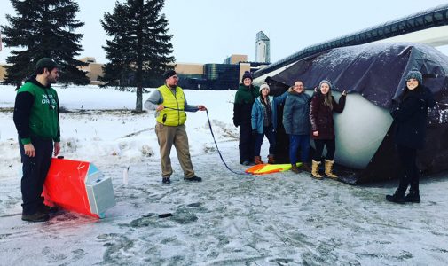
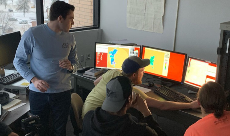
For the recent BLOWN-UNDER campaign (Blowing Snow Observations at the University of North Dakota: Education through Research), Kennedy mustered a university-operated C-band radar, a nearby NOAA S-band radar, and an X-band dish mounted on a Doppler on Wheels truck on loan from the Center for Severe Weather Research in Boulder, Colorado.
But it was not until February 12 that the team struck cold gold, captured by a local television crew: what was to become “the best-observed ground blizzard ever,” says Kennedy. Not only were the triangulated three radars in just the right place, so was the ceilometer, a perfectly timed satellite overpass, and an instrumented balloon launched just before the full force of the storm.
“Across the board,” he says, “it was a home run.”
Storm Chaser
Kennedy, who grew up in a military family, spent his first eight years in the Southeast, where tropical cyclones are not uncommon. His father was a pilot at Marine Corps Air Station Beaufort in South Carolina.
From there, the family moved to Illinois, a region of “crazy-intense thunderstorms,” says Kennedy.
His interest in extreme weather events drew Kennedy to the meteorology program at the University of Oklahoma (B.S. 2004, M.S. 2006), in a region where thunderstorms rolled in like freight trains and tornadoes spun across the open plains.
“The debate always was: Do we go to class―or do we storm-chase?” says Kennedy.
Over six years, when the forecasts were promising, he says, “we would drive all over Oklahoma, Kansas, and Texas looking for severe weather.”
He wrote a master’s thesis on radar observations of the supercell thunderstorms that spawn many tornadoes.
Just Add Snow
For his PhD, Kennedy moved to the University of North Dakota (PhD 2011).
“I went from tornado alley to blizzard alley,” he says. “It was a part of the country that seemed exciting.”
Kennedy’s dissertation incorporated ARM data at the Southern Great Plains (SGP) atmospheric observatory and employed some of the same techniques at play in his current blowing-snow project for ASR.
After earning his degree, he stayed on at the university to do a “mini-postdoc for ARM,” says Kennedy. That continued work with self-organizing maps and radar and lidar observations at SGP led to a 2015 paper on reducing cloud-fraction uncertainty.
After that, he started a two-year NSF modeling project―interrupted after a year by an offer to become a professor starting in 2013.
“Off duty,” as Kennedy phrases it, he takes long bike rides on remote gravel roads and, when he can, wheels into the woods on bike-packing trips of several days.
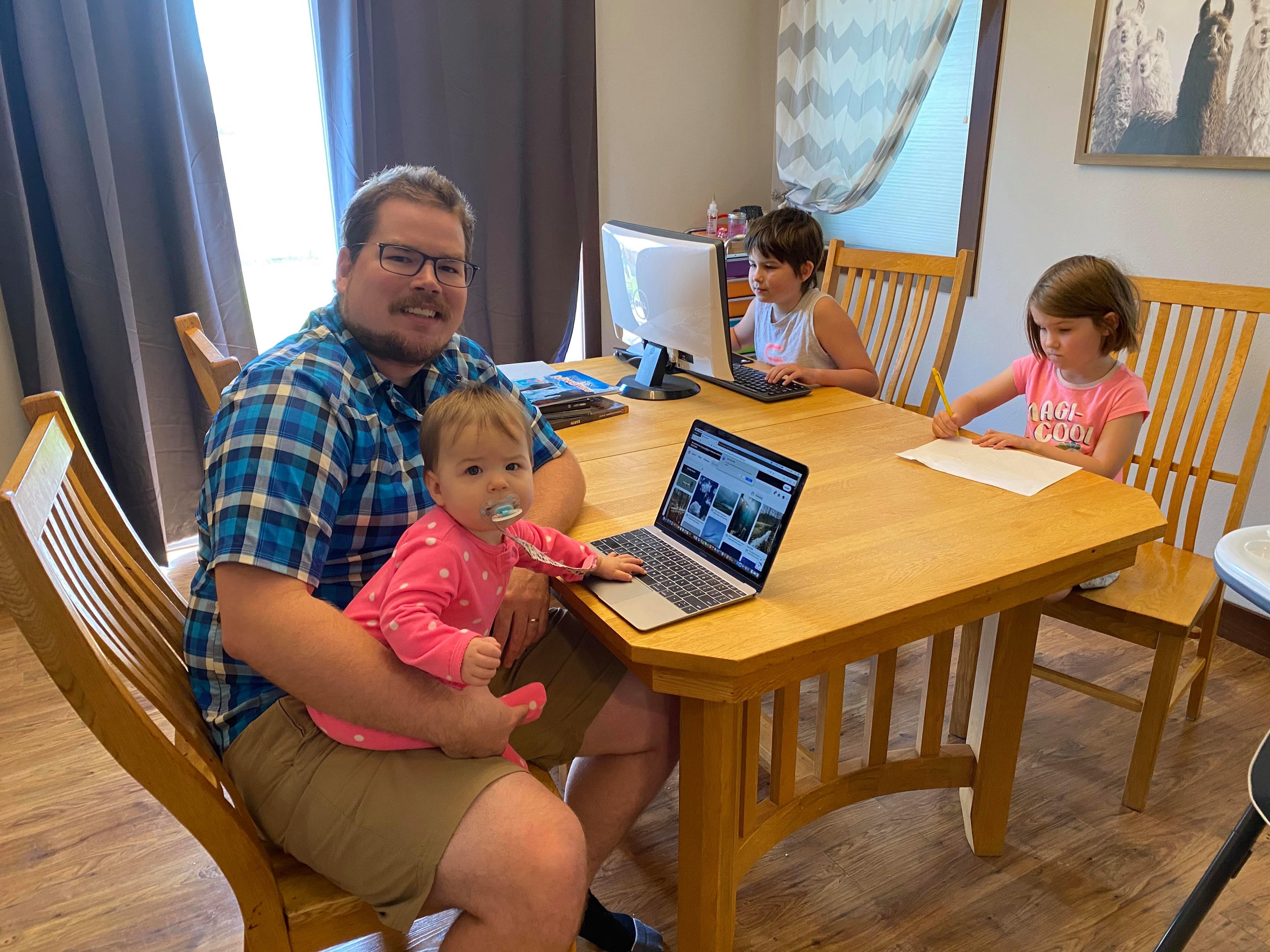
He and his wife, Jimmie, a human resources manager at a local hospital, trade off supervising three lively daughters―Zoey, age 9; Carter, 5; and Juniper, who is 9 months old.
A self-described “hands-on guy,” now largely captive in the house, Kennedy is remodeling the basement.
It is already, says the storm-chaser and blizzard hunter, “a safe place to hang out.”
# # #This work was supported by the U.S. Department of Energy’s Office of Science, through the Biological and Environmental Research program as part of the Atmospheric System Research program.