One veteran ASR scientist leads a campaign to establish benchmark datasets measuring the dominant physical mechanisms that impact hydrology in mountain terrain
Modern sailboats can heel far to one side as they pick up speed, pushed by the wind. But they are nearly impossible to capsize because of a stabilizing heavy fin at the bottom of the boat―the keel.
Every project that stays on course and picks up speed and gets anywhere has a keel, which in management terms is a central figure who provides stability and direction.
So it is with a coming field campaign called SAIL, the streamlined acronym for the Surface Atmosphere Integrated Field Laboratory. Its steady-hand captain―lead scientist―is Daniel Feldman, a climate-modeling and remote-sensing expert at the Lawrence Berkeley National Laboratory in California.
From September 2021 through June 2023, the all-season investigation will sweep up 21 continuous months of measurements on the land-atmosphere processes that steer mountain hydrology in the Upper Colorado River Basin. That’s the part of the Rocky Mountains from which nearly all of the Colorado River’s water originates.
“SAIL is motivated by interest in water resources,” says Feldman. “Forty million people rely on the Colorado River for water, power, and economic activity.”
He outlined the SAIL science goals as flowing from this primary interest:
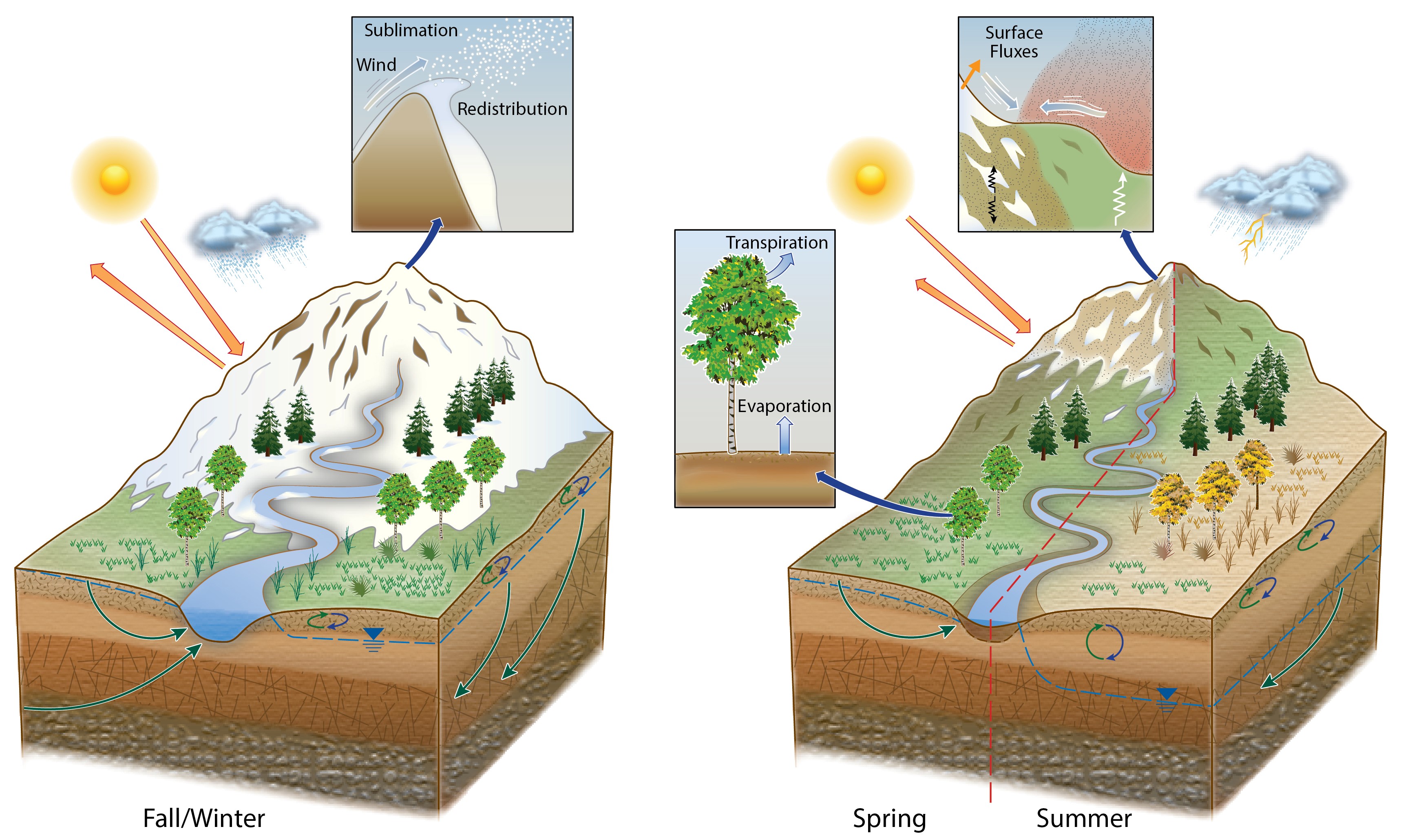
- To advance observations and modeling of mountainous hydrology in tandem. He says that will “determine the level of detail we need to understand, model, and predict how the Colorado Rockies interact with the atmosphere to extract moisture from the air and ultimately deliver that water into streams and rivers.”
- To focus on the details of the physical processes that control water resources in the Rockies. SAIL scientists will measure how precipitation forms and why is it so variable across terrain and across seasons; how winds move around and erode the snowpack; how aerosols warm or cool the atmosphere and surface while also impacting precipitation and snowpack; and how surface energy terms are set by local and remote conditions.
- To establish benchmark datasets that modelers and other researchers can use now and into the future. Models at a range of complexities can be constrained and their errors revealed from a wide range of observations that SAIL will collect, says Feldman. “The physics that govern water in Colorado’s Rocky Mountains can be revealed in exquisite detail.”
Going Gothic
Water has been a central concern for the Western United States for generations, but the scientific understanding of the remote watersheds from which water originates has faced one plain fact, says Feldman. “It’s a radar black hole.”
That is, it’s a place where not a lot of atmospheric science instrumentation has been deployed. And where there is a great mismatch between the people impacted directly and those impacted indirectly by weather and climate in remote regions of the Colorado Rockies.
It’s also a region where there is such a wild variability in snow and rain. In the SAIL study area, for example, one place will get “twice as much precipitation as another that is only 10 miles away,” says Feldman.
Hydrologists have been clamoring for integrated atmosphere-through-bedrock observations for years, recognizing that science gaps cannot be filled where atmospheric and surface, and sub-surface research are performed in isolation.
To address these hydrological science gaps, SAIL will be crewed by many institutions, starting with its chief source of technical support, the Atmospheric Radiation Measurement (ARM) user facility within the U.S. Department of Energy (DOE).
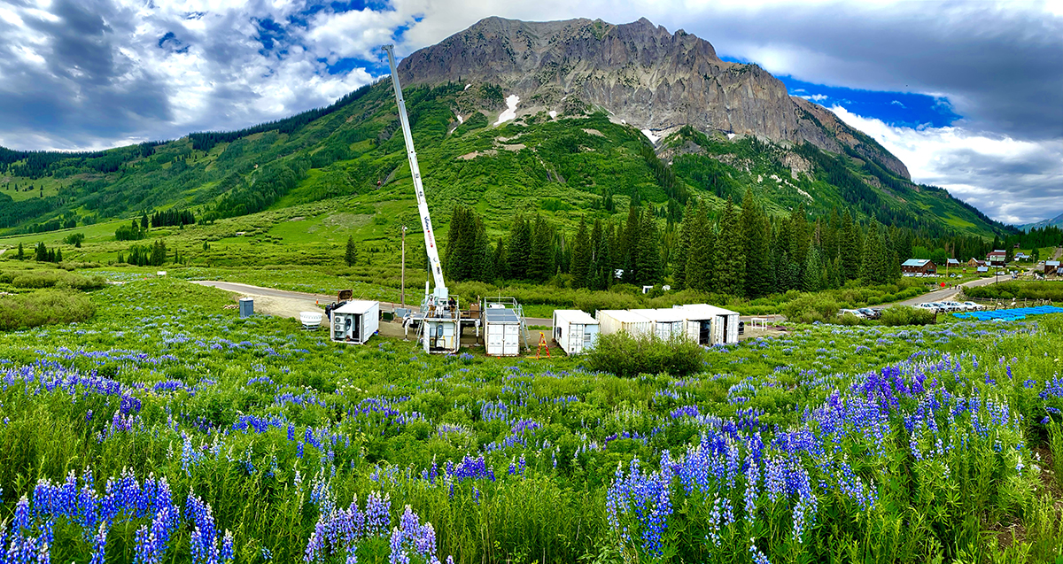
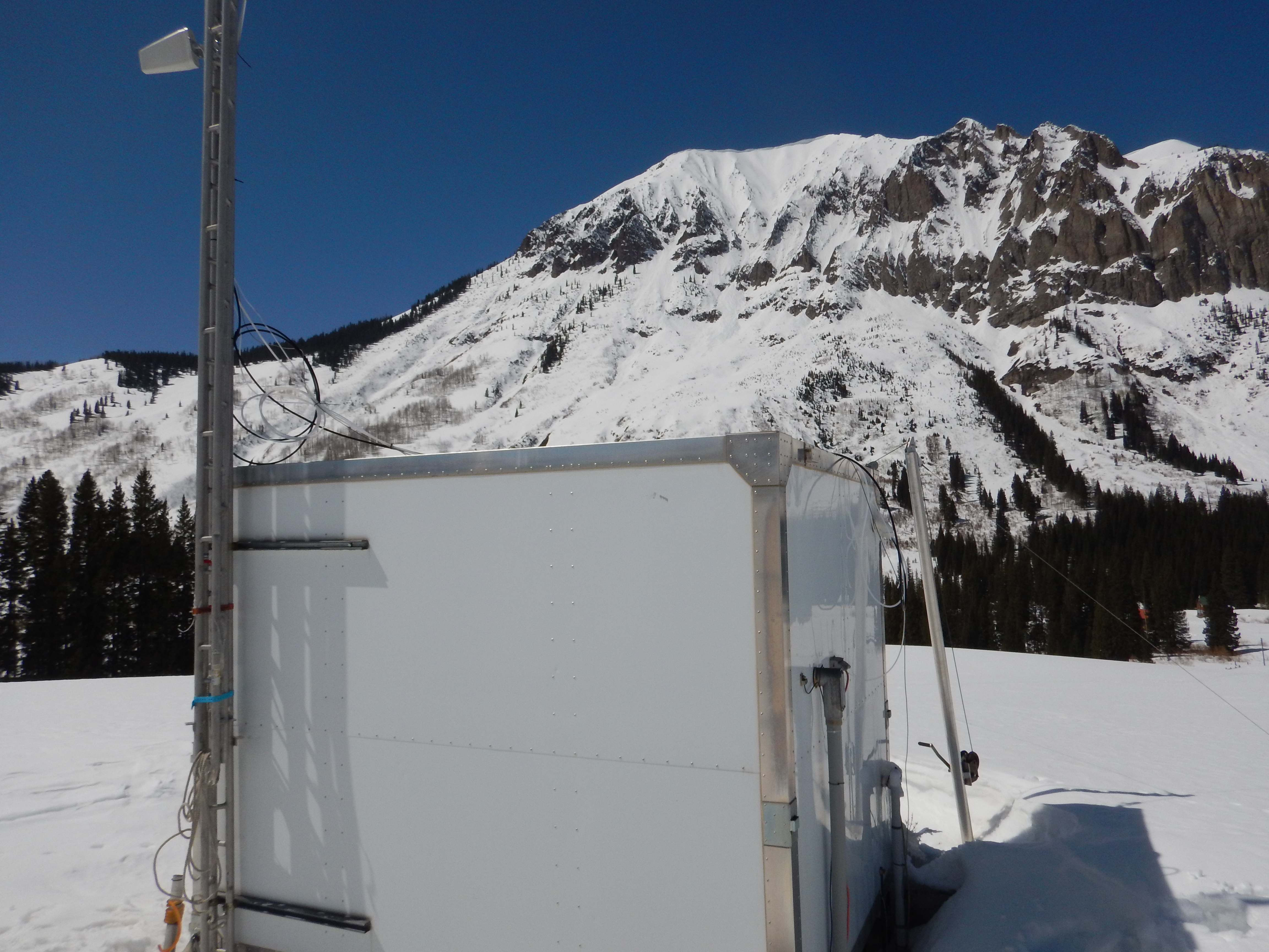
ARM has already placed its 50-instrument second ARM Mobile Facility (AMF2) in Gothic, Colorado, as explained in a video featuring SAIL co-investigator and Berkeley Lab geologist Kenneth H. Williams. (In June 2021, site setup for SAIL began.)
SAIL instruments will be located near a Clean Air Status and Trends Network (CASTNET) site in Gothic. It contains instrumentation to measure aerosol composition and has been doing so for decades.
Gothic is a ghost town from Colorado’s nineteenth-century silver mining days, referred to as a “townsite.” It was largely deserted before biologists recognized the unique value of the area and founded the Rocky Mountain Biological Laboratory (RMBL) in 1928. RMBL has been a scientific research organization ever since. It serves as a key partner for the SAIL campaign and a host of the AMF2.
Nearby, in Mt. Crested Butte, Colorado, at the site of a ski resort, ARM has set up both the Aerosol Observing System and worked with Colorado State University to install a guest scanning X-band precipitation radar.
While Feldman is guiding the SAIL campaign, he is also a long-time recipient of research funding from DOE’s Atmospheric System Research (ASR) program, with research largely focused on radiative processes.
In the Colorado Rockies, he recognizes that the research focus areas of ASR (precipitation, aerosols, land-atmosphere interactions, and radiation) all come together to advance hydrological science―with precipitation being the first piece of the puzzle.
“ASR has priorities associated with understanding precipitation processes,” Feldman says. “Precipitation is the biggest single source of uncertainty in getting the water right. We need to understand how precipitation is actually occurring as a function of large-scale and local-scale weather in complex terrain.”
Other pieces of the puzzle also interact to bring water to the area, as shown below.
The SAIL Crew
SAIL has a large crew. Its science team includes co-investigators from four national laboratories, two research centers, and 10 universities. Its experts span a broad and deep range of study areas, including precipitation processes, aerosol and aerosol-precipitation interactions, snow processes, land-atmosphere processes, and modeling.
SAIL has also brought along another ship: from fall 2021 to summer 2022, NOAA will execute a sister campaign, the Study of Precipitation, the Lower Atmosphere and Surface for Hydrometeorology (SPLASH), which has co-deployed and nearly co-located instrumentation. Scientists will install a weather-and-water prediction network of instruments that Feldman says will “provide a different, but complementary, set of observation and modeling capabilities.” In the lead is NOAA research scientist and ARM and ASR veteran Gijs de Boer.
During SAIL, Berkeley Lab’s Watershed Function Science Focus Area (SFA) will study subsurface biogeochemical processes that link the atmosphere to what is underground. In this way, scientists will learn more about bedrock-through-atmosphere fluxes of water from a mountain watershed.
Any terrain contains an interactive complex of vegetation, soils, and subsurface compartments that help drive hydrologic processes―most of them riven with predictive uncertainties. The Berkeley Lab SFA will use SAIL as a testbed for subsurface measurement tools and techniques. The SFA’s deputy lead and chief field scientist is SAIL co-PI Williams, who lives a short drive from the SAIL study area.
SAIL is also advancing connections with the Terrestrial Hydrology Program at the National Aeronautics and Space Administration (NASA) and the U.S. Geological Survey’s Next Generation Water Observing System (NGWOS).
“SAIL is engaged with SnowEx to pursue complementary co-observations to advance snow process understanding, where possible,” says Feldman, referring to NASA’s investigation of snow characteristics and how they change over time in different terrain.
Meanwhile, the NGWOS program is heavily instrumenting a wide swath of the Upper Colorado River, including the SAIL study area. It will work together to connect the atmosphere to streams and rivers.
Worldwide, more than a billion people depend on water that comes from snowpack. SAIL’s observations and science can complement the SnowEx goals of establishing instruments and techniques needed for a future satellite mission to determine how much water the world’s snowpack contains. The campaign can also help with NGWOS’ goals of providing high-fidelity, real-time data on water quantity and quality.
“I’m reaching out to a number of different communities,” says Feldman. “It’s been an incredible honor and incredibly eye-opening to meet and learn from experts across so many disciplines.”
First and foremost are the communities that develop and use ARM data and perform science supported by ASR bring both broad and deep understanding of many sub-disciplines of atmospheric science that are directly related to SAIL.
“They bring the domain-specific expertise,” says Feldman. “How instruments work and what nature is telling us through them, specific to understanding mountainous hydrology.”
Other groups, including local and state partners, NOAA’s SPLASH, NASA’s SnowEx, and USGS’s NGWOS, he adds, bring “learning and collaborative opportunities.”
ASR Efforts
During all this, Feldman has a part in two ASR projects.
One of them, predictably, is “focused on leadership and outreach activities for SAIL,” he says, including a website and waves of virtual calls with cooperating partners, scientists, and agencies. “The idea here is to maximize the scientific return on the SAIL investment, ARM hardware, and personnel.”
Feldman is also co-investigator on the “Study of Convective Cloud Life Cycles Using ARM Observations,” an ASR project led by David Romps at the University of California, Berkeley.
Not long ago, Romps, his team member Rusen Öktem, and the others wrapped up an ASR-funded project on a new variation of an established measurement technology called stereophotogrammetry. (Will the technology be used during SAIL? “Hopefully,” says Feldman.)
“Since I’m a radiation scientist at heart, I’m also working on David Romps’ project with other ASR researchers to advance radiation research,” he says. “David and I have riffed on some really cool ideas to look into the intricate, strange, and fascinating ways that water vapor acts as a greenhouse gas.”
Water Predictions
Despite other research, mainly SAIL is filling Feldman’s mainsail and jib these days.
The water sources that propel SAIL “are decreasing in the last decades and may well further decrease,” he says. “Given the steady drumbeat of stories in the news about record drought in the Colorado, we are finding that the campaign is nothing if not timely.”
That brings up the state of models on mountain hydrology, which Feldman says needs to have better representations of complex processes to “predict how much water will come out of these mountains.”
Is that water falling in the form of rain or snow? How does the terrain actually extract moisture? How do aerosols affect that moisture-extraction efficiency? How does land―the slopes and valleys of mountain terrain―affect long- and short-term radiation across seasons? Such questions crash against SAIL’s bow.
The key to some of the answers is having the right instruments in the right places over a long period of time, says Feldman. “We hope to drill down to the details. To turn a phrase, models have to be properly instrumented to make robust predictions.”
In the end, “we need to get the water right,” he says. “With ARM providing this incredible level of detail, we have an opportunity to develop a dataset and analysis to get to that point. The goal is to develop models that we can use to make projections confidently.”
Rough SAILing
Altitude matters. The higher up the work goes in field campaigns, the deeper the challenges become.
SAIL is no exception, says Feldman, who noted that the headwaters of the Colorado River are at between 9,000 feet and 13,000 feet in elevation. “Even the lowest points are pretty high.”
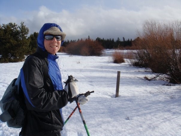
Altitude makes breathing a struggle, as well as just getting from A to B. Some parts of the Upper Colorado Watershed understudy during SAIL are accessible all year, such as Mt. Crested Butte. But the campaign and some of its instruments and technicians can only get to Gothic with back-country skiing: while limited supply-runs are allowed, snowmobiles are generally not. That means planning is essential.
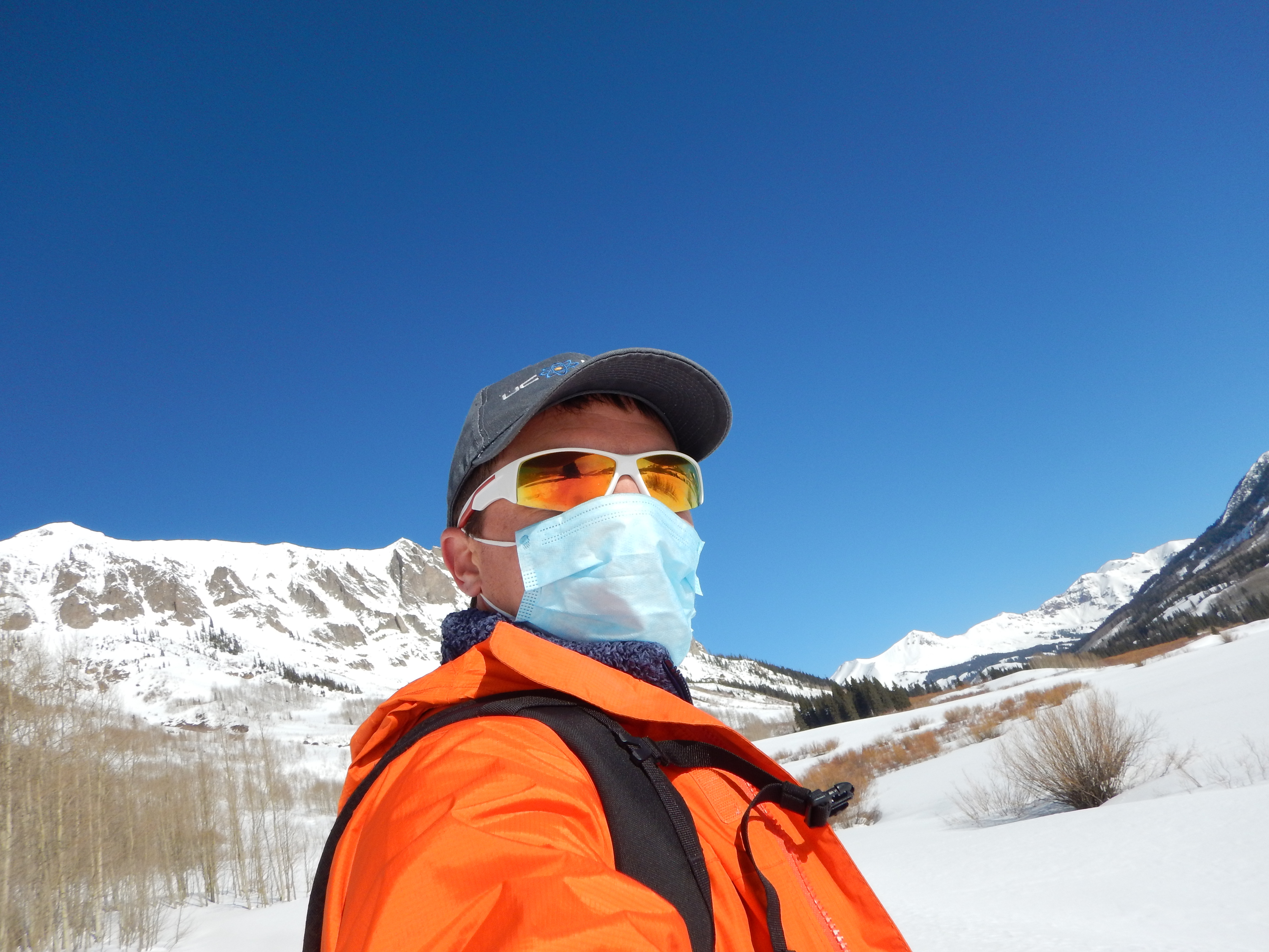
Another fact of life that SAIL faces is that parts of the East River Watershed are in avalanche country (“part of the safety plan,” says Feldman). With the changing seasons come changing logistics challenges. Spring is called “mud season” by the locals and with good reason.
In summer, there are major convective storms, says Feldman, making the physical challenges of a mountain campaign, in sum, “quite substantial.”
Moving Forward
After SAIL packs up in September 2023, says Feldman, “we’re going to be thinking hard about what the data have told us and how we can ask and answer questions we couldn’t ask and answer before.”
Of course, he adds, “the science articles (to be published afterward) are the fun part. We will have collected a substantial amount of data we can sink our teeth into for quite some time.”
SAIL will also be a proving ground for new technologies used to study the atmosphere and subsurface in complex terrain, including with low-cost, low-maintenance networks of sensors.
“We have a 21-month runway,” says Feldman, for testing such technologies. “They can complement and prove themselves in the natural laboratory setting that ARM’s more sophisticated instruments provide.”
SAIL will tack from trying to understand the contribution of terrain to snowmelt, to how the winter-spring transition is accelerated by dirty snow, to changes in land-atmosphere radiative patterns, and finally to the hydrological impact of summer convective storms.
“In the last few years,” says Feldman, touching on his own research expertise, “the usual monsoons have failed to appear. There’s a strong radiation component in that.”
Journey to SAIL
For a long time, studying radiation of the atmospheric kind has been part of Feldman’s research portfolio. Radiative forcing is used to quantify how human activity and natural events (wildfires, for instance) alter how energy flows in and out of the climate system.
Electromagnetic radiation beams to Earth from the Sun through millions of miles of space. The atmosphere, with its clouds and aerosols, blocks some of that shortwave energy and also influences the fate of longwave radiation streaming upward from land and oceans.
Calculating how all that interacts is the basis of determining the Earth’s energy budget. Accuracy depends on mathematical models informed by observations, the crux of Feldman’s work.
Feldman’s second most-cited paper, a 2015 study he led published in the journal Nature, provides evidence that rising carbon dioxide levels affect the Earth’s surface energy balance.
A few years later, he was senior author on a paper in Science on reducing radiative forcing uncertainties in global climate models.
Feldman’s journey to radiation and models and SAIL, outlined in a 2019 profile, started in his native Portland, Oregon, where he actually did a bit of the nautical variety of sailing when he got the chance.
There were stops at the Massachusetts Institute of Technology (where he was an All-American middle-distance runner and sailed on the Charles (“while avoiding the water,” he says), the California Institute of Technology (PhD 2008 and work on Earth-observing satellites), and the University of California, Berkeley (until 2011, when he joined the Berkeley Lab).
Feldman submitted his SAIL proposal in 2019; its acceptance soon after meant that his work and life have focused substantially on atmospheric science questions.
Preparation has included three visits to the campaign site in the remote, rough, science-promising high country, where Feldman says, “the running is fantastic.”
It’s perfect for SAILing, too, and he holds out hope for “a way to actually sail there too.”
# # #This work was supported by the U.S. Department of Energy’s Office of Science, through the Biological and Environmental Research program as part of the Atmospheric System Research program.