A veteran weather researcher leads a quest to better understand the stratiform regions of convection
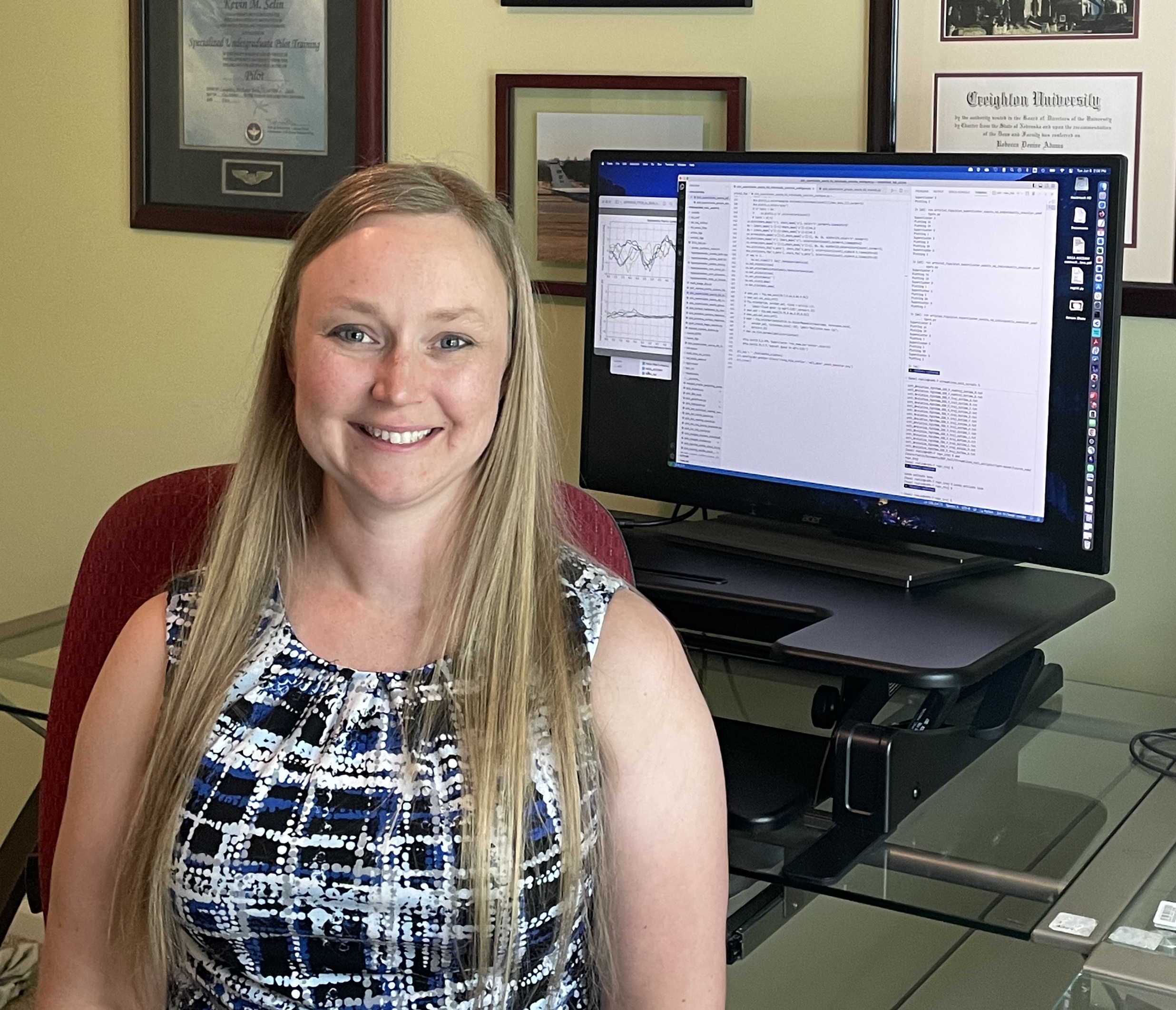
Atmospheric scientist Rebecca “Becky” Adams-Selin grew up in storm-crossed western Nebraska. At age 6, in the first sign of her future career, she set up a tornado-forecasting station in her backyard.
“I don’t remember much more than that,” she says, except that she persuaded the neighborhood paper boy to help. “I drafted him.”
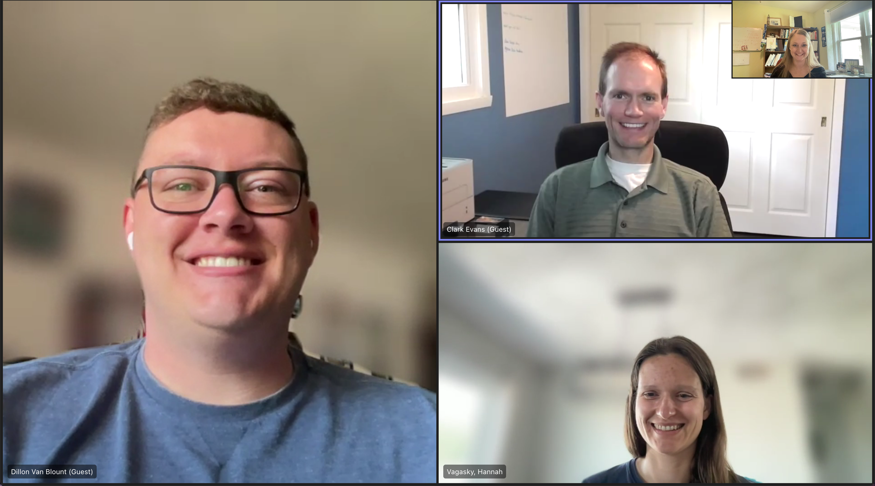
Fast forward all those years, and Adams-Selin is up to something far grander: a weather-research project that includes―this time―three draftees. Joining her are Clark Evans, a professor at the University of Wisconsin-Milwaukee; Hannah Vagasky, a senior research associate at Atmospheric and Environmental Research (AER) in Lexington, Massachusetts; and Wisconsin PhD student Dillon Blount.
Based in Omaha, Nebraska, Adams-Selin (like Vagasky) also works for AER. She is a senior manager of science of the Modeling Atmospheric Components and Processes Section.
Starting in September 2022, the four researchers launched their ambitious effort to investigate and model some little-understood features of mesoscale (regional-scale) convective systems. These storm systems, which provide most of the world’s summertime rainfall, can be very large―the size of a midwestern state or two.
Their three-year project is funded by the Atmospheric System Research (ASR) program at the U.S. Department of Energy (DOE). Its full name takes just shy of three years to read: “Establishing a Holistic Understanding of the Circulations of Mesoscale Convective System Stratiform Regions.”
A Data Boost from ARM
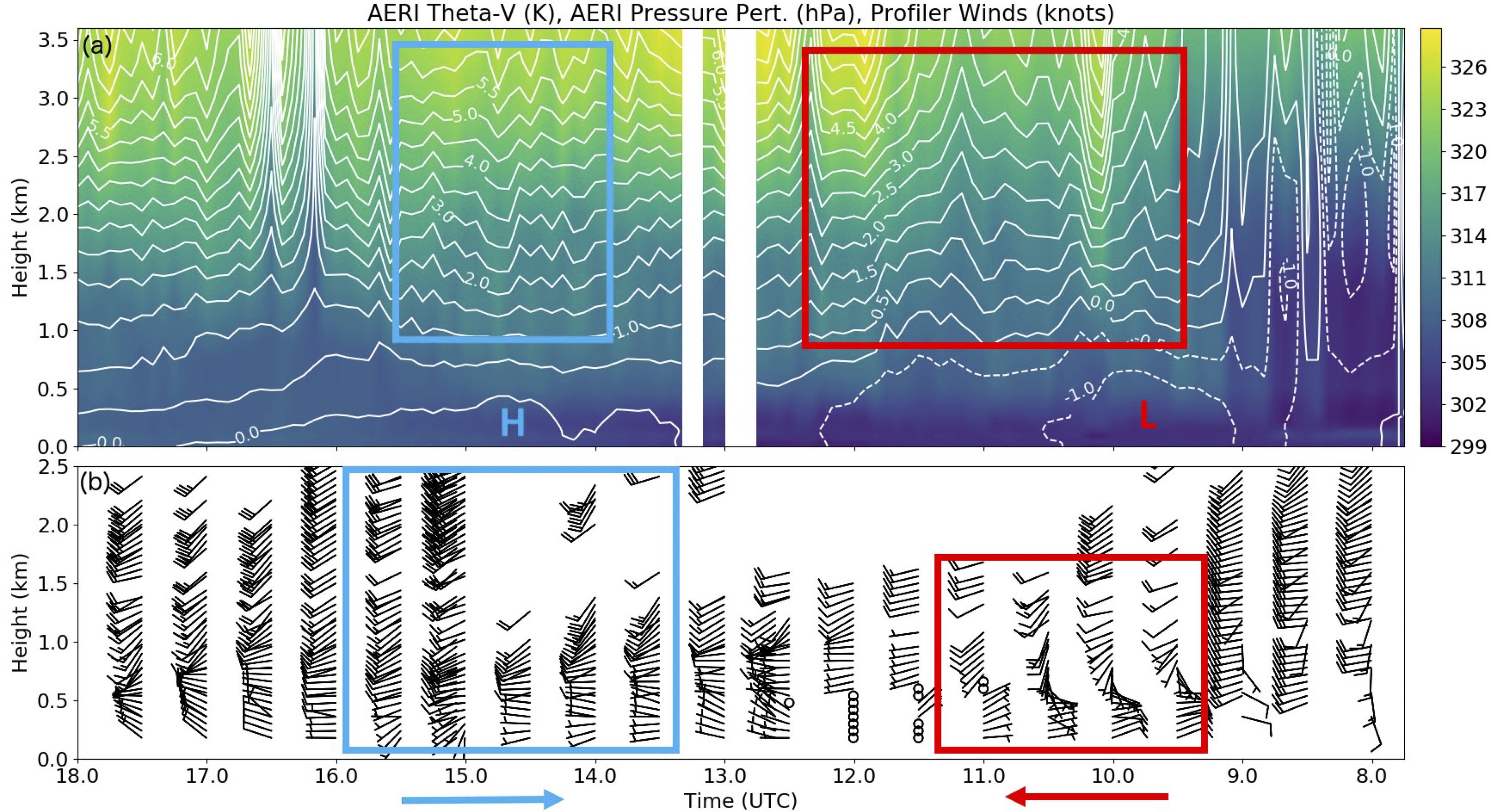
So far, the researchers are looking through datasets, merging surface radar data to retrieve 3-D snapshots of cloud winds (a Vagasky specialty), and identifying promising examples of observed gravity waves. These ripple-like air motions, often from thunderstorm updrafts, propagate vertically through stable regions of air within a cloud system. Over mountains, they produce clear-air turbulence.
With such preliminary steps, “we are just getting started,” says Adams-Selin.
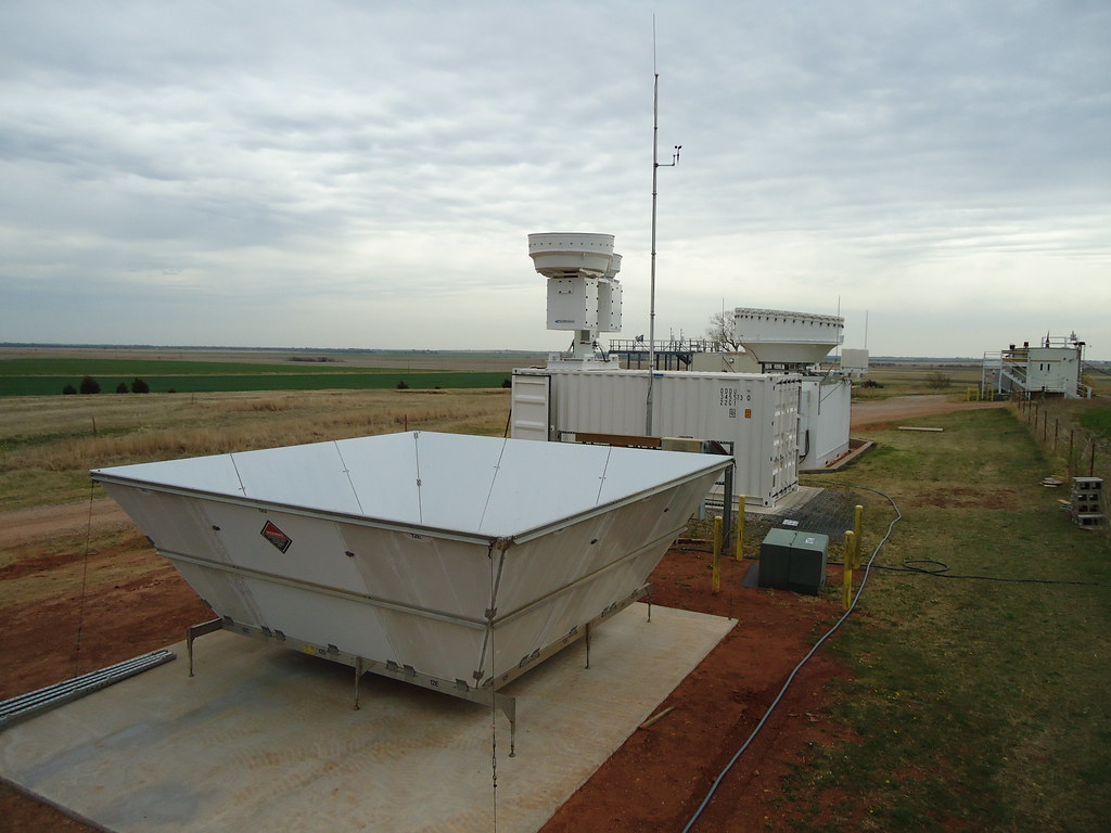
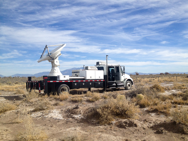
One thing is certain, however: The bulk of the project data will come from two past field campaigns operated by the DOE’s Atmospheric Radiation Measurement (ARM) user facility.
The 2011 Midlatitude Continental Convective Clouds Experiment (MC3E) took place at Southern Great Plains (SGP), ARM’s oldest and biggest atmospheric observatory. In 2015, the multi-agency Plains Elevated Convection at Night experiment (PECAN) also unfolded at SGP.
Both field campaigns deployed numerous surface instruments to capture data on low levels around convective storms, says Adams-Selin, providing “the best look into convective systems.”
Untangling Stratiform Regions
At the heart of the ASR project is a challenge: How these complex mesoscale storm systems organize themselves is not well known.
These systems made mostly of the towering cumulonimbus clouds that foretell the menace of heavy rain, are marked by large cloud shields. They are accompanied by peripheral fields of “stratiform precipitation,” linked to older regions of clouds.
Stratiform clouds, the project’s main target, have weaker vertical air motions, producing rain that tends to slowly drift Earthward. That’s unlike the violent, heavy showers from younger portions of the cloud mass, which are subject to unstable vertical updrafts carrying moisture.
The stratiform regions of convective cloud systems “get complicated very fast,” says Adams-Selin.
They not only generate their own updrafts, clouds, and precipitation, but they are also being fed lots of momentum and moisture from the nearby younger cumulonimbus clouds. That makes stratiform regions hard to simulate in predictive models.
“You have to get both the younger and older parts of the storm right,” she says.
Gravity Waves
Adams-Selin described the ASR project as “a dynamics take” on convective system stratiform regions. “We’re worried about the wind flows―winds in the environment and those in the storm itself,” including those generated by gravity waves.
She is especially interested in low-frequency gravity waves, which are active for an hour or two, which is longer than normal. Such waves can propagate outward from a storm, generating in-storm air flows.
Adams-Selin asks: What does such to-and-fro of winds do to the latent heating profile of a storm?
The ASR team is investigating wind flows around and within the storm, which can tilt the cyclonic vortices within a cloud system. Combined with gravity waves, these vortices drive a rotation of air that can be seen on radar.
Hail Trajectories
Aside from the long menu of wind flows involved in stratiform regions, the ASR team will take an exploratory look at what shapes the hydrometeors (falling ice and water) within a storm take on. These shapes themselves can, eventually, create gravity waves.
Adams-Selin pointed to a pair of her 2020 studies on low-frequency gravity waves. One was on waves generated during convection and how no systematic studies have been done. The other demonstrates how sensitive low-frequency gravity waves are to the size variations of rimed ice.
“Rimed” ice crystals are those that have become fully encased in supercooled water droplets frozen on their surfaces.
Influenced by the kind of in-cloud air motions studied in the ASR project, hail is a long-standing feature of research by Adams-Selin. That includes schemes to forecast these iconic pellets of compacted ice and snow.
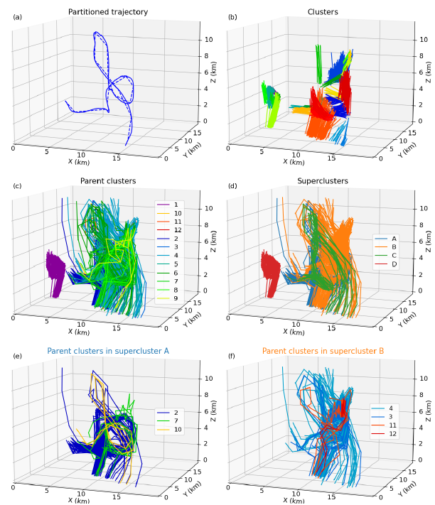
Her most recent hail study went online in May 2023. It describes a strategy, aided by machine learning, to simulate 3D clusters of hail trajectories. There are millions of them, a complex but largely linear series of paths that she compares to a room swarming with mosquitoes.
‘That Cemented It’
During her childhood, Adams-Selin was more than the girl with tornado-forecasting gear in her backyard.
At age 12, her interest in studying weather intensified after a dramatic escape in the family car from a storm “with very strong winds behind it,” says Adams-Selin. “It was very, very nerve-wracking.”
But that cemented it, she remembers. “I wanted to learn more about the weather.”
Adams-Selin leveraged an already strong interest in science and math into a summa cum laude undergraduate career at Creighton University in Omaha (B.S. atmospheric science and mathematics, 2005).
While there, she interned at the National Weather Service office in nearby Valley, Nebraska, working with Dan Neitfeld, the first in a long line of weather-science mentors. (He’s now in Boulder, Colorado, with NOAA.)
The internship, she says, “was my first foray into researching and understanding why the weather happened.”
Bow Echoes
After Creighton came graduate work in atmospheric science at Colorado State University (M.S. 2007, PhD 2012).
Adams-Selin fell into step with advisor Richard Johnson, now retired, who “did a lot of seminal work on understanding the structure of mesoscale convective systems,” she says.
Her master’s degree thesis “is related to this ASR project,” says Adams-Selin. “I was looking at a subset of mesoscale convective systems that have some really high winds.”
In fact, part of her study involved bow echoes, straight-line wind systems that, on a radar image, resemble the bow of an archer. They are associated with severe winds of the kind that chased Adams-Selin and her mother and sister across the Nebraska countryside.
“They are really strong and destructive,” she says, but also have links to gravity waves, which were explored in her master’s work.
An AER Break
At the start of her PhD work, things got a little complicated for Adams-Selin: She married a military officer, whose postings were bound to jump from here to there.
From 2007 to 2009, Adams-Selin was a visiting scientist with the University Corporation of Atmospheric Research at the Air Force Weather Agency in Nebraska. Then in 2009, very fine luck appeared: a job with AER, which allowed her to both work remotely and to work on her PhD. (Johnson, her advisor, supported her peripatetic path to the degree.)
Adams-Selin described the AER experience (she is in her 14th year) as something akin to a national laboratory: research groups work on science and write papers and proposals. There are about 25 people in the research group she leads, working from the Midwest to New England.
“I could continue in science,” she says, “because of AER’s commitment to remote work.”
The Adams-Selin group, many of them women facing similar domestic pressures, focus on a wide range of things not necessarily in the wheelhouse of her own interests. One scientist is working on carbon fluxes in the Amazon and another on software for analyzing trace gases.
“It keeps me open,” she says. “You can supervise and help mentor someone whose interests aren’t necessarily aligned with yours. Science is science.”
At AER, Adams-Selin met another mentor who has helped steer her path to the PhD and beyond: Eli Mlawer, a Massachusetts-based expert in radiative transfer.
“He has been fantastic and supportive,” she says. “And he taught me how to be a PI (principal investigator).”
Finding a Default Speed
For her PhD dissertation, Adams-Selin developed models to further explore the gravity wave-bow echo link. But she also examined how different hydrometeor profiles can impact bow echoes.
That work has a second life as a research thread in the ASR project. After all, different hydrometeor profiles will create different latent heating profiles―and, in turn, have different influences on gravity wave generation.
In models, says Adams-Selin, “if you change some assumptions about rimed ice, that can have impacts on the rest of your (simulated) storm.”
In life outside science, Adams-Selin is joined by her husband, now a pilot for Southwest Airlines, and their two children, ages 9 and 5.
She is a recreational runner who switched from half-marathons to 10-K races as the years passed.
“I’ve learned that if you have a pretty slow default speed, you can keep going for a while,” says Adams-Selin, in defense of the slow-and-steady approach favored in science. “Eventually, you outlast the faster people. That’s my strategy.”
# # #Author: Corydon Ireland, Science Writer, Pacific Northwest National Laboratory
This work was supported by the U.S. Department of Energy’s Office of Science, through the Biological and Environmental Research program as part of the Atmospheric System Research program.