An ARM field campaign in Colorado ends an epic phase of observations and begins its focus on data analysis and modeling
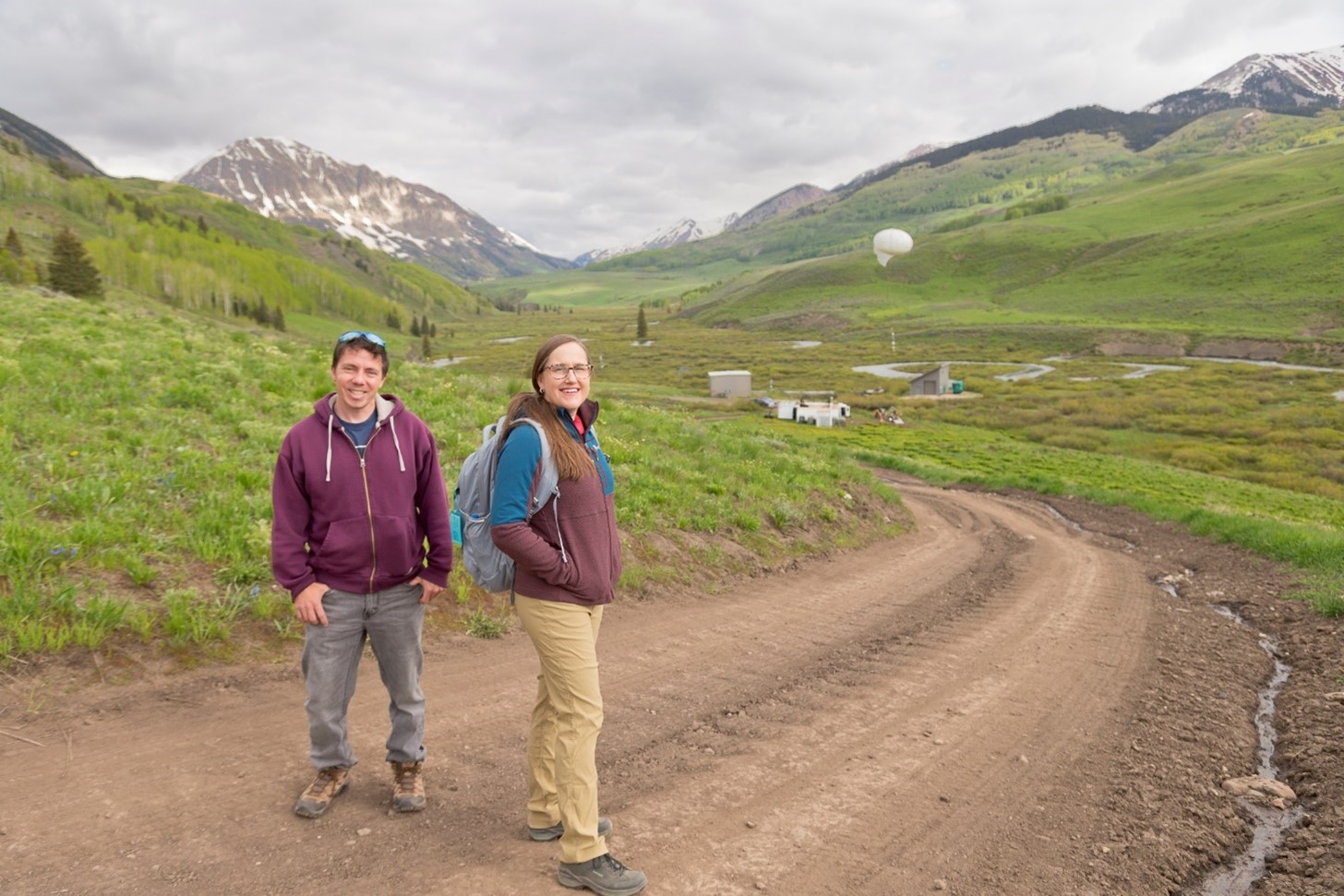
In early June 2023, Daniel Feldman and Allison Aiken hiked along a mountain trail in a region of Colorado where distant peaks jutted into the sky and stands of forests seemed to rise out of a landscape painting.
Undistracted by the scenery, the two atmospheric scientists talked about the last days of observations—and the next steps—for an epically comprehensive, 21-month investigation into mountain hydrology called the Surface Atmosphere Integrated Field Laboratory (SAIL) campaign.
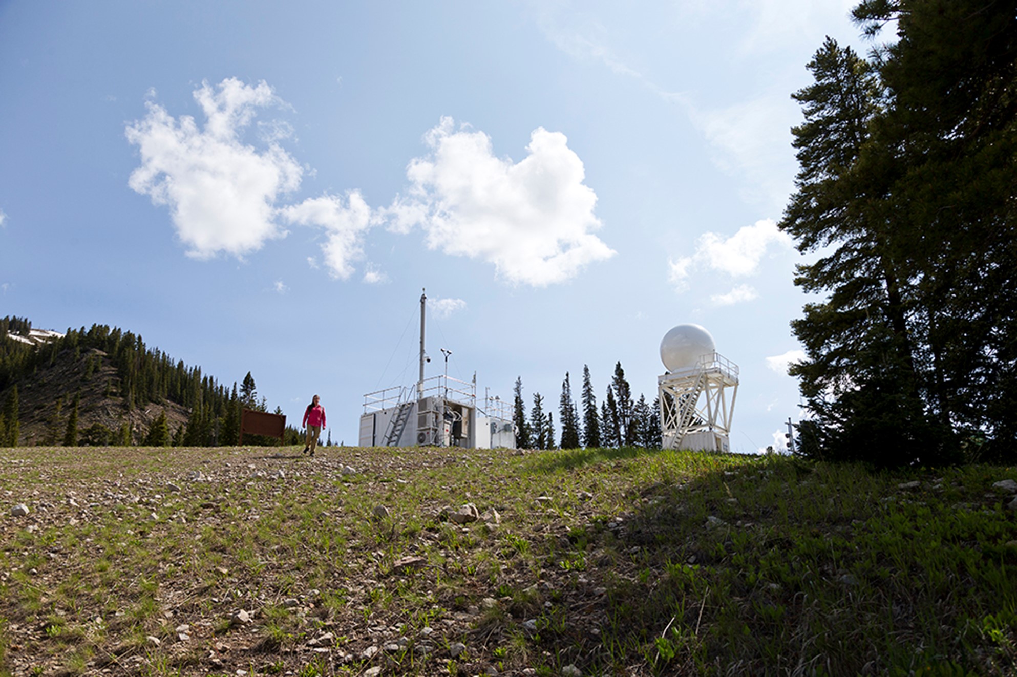
The picture-perfect setting is the East River Watershed near Crested Butte, Colorado: almost 200 square miles of hard-to-measure complex terrain―mountain forests, elevations, valleys, bare rock, and threading streams starting to run fast with melting winter snowpack.
Feldman, a researcher at Lawrence Berkeley National Laboratory in California, is SAIL’s principal investigator. Aiken is a SAIL co-investigator and scientist at Los Alamos National Laboratory in New Mexico. She specializes in atmospheric aerosols, tiny particles of gases, water, and solids that make clouds and rain possible.
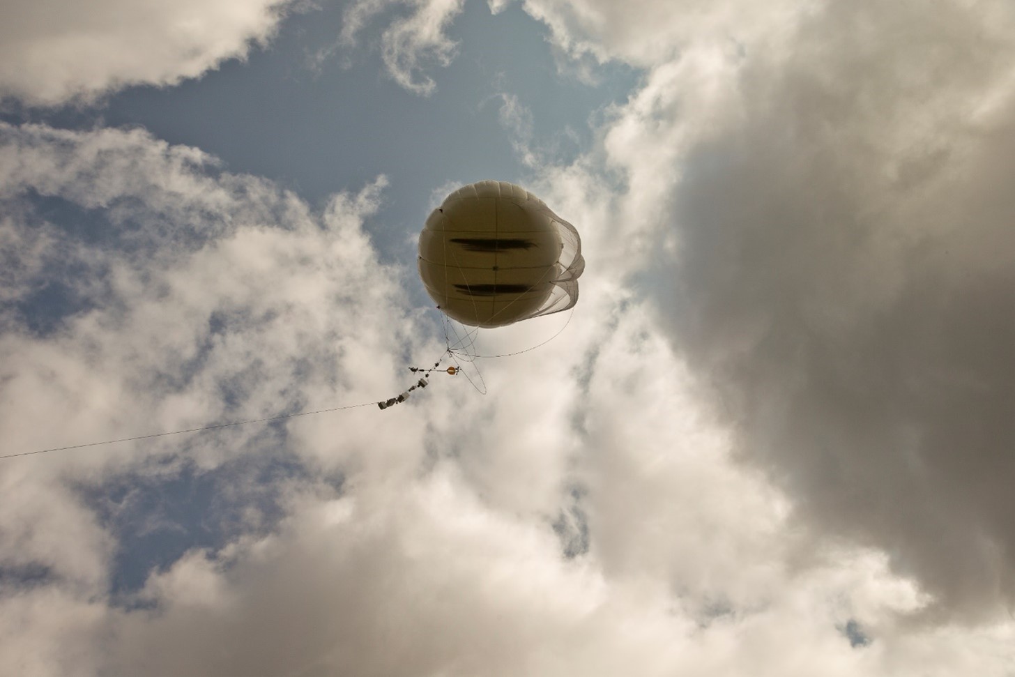
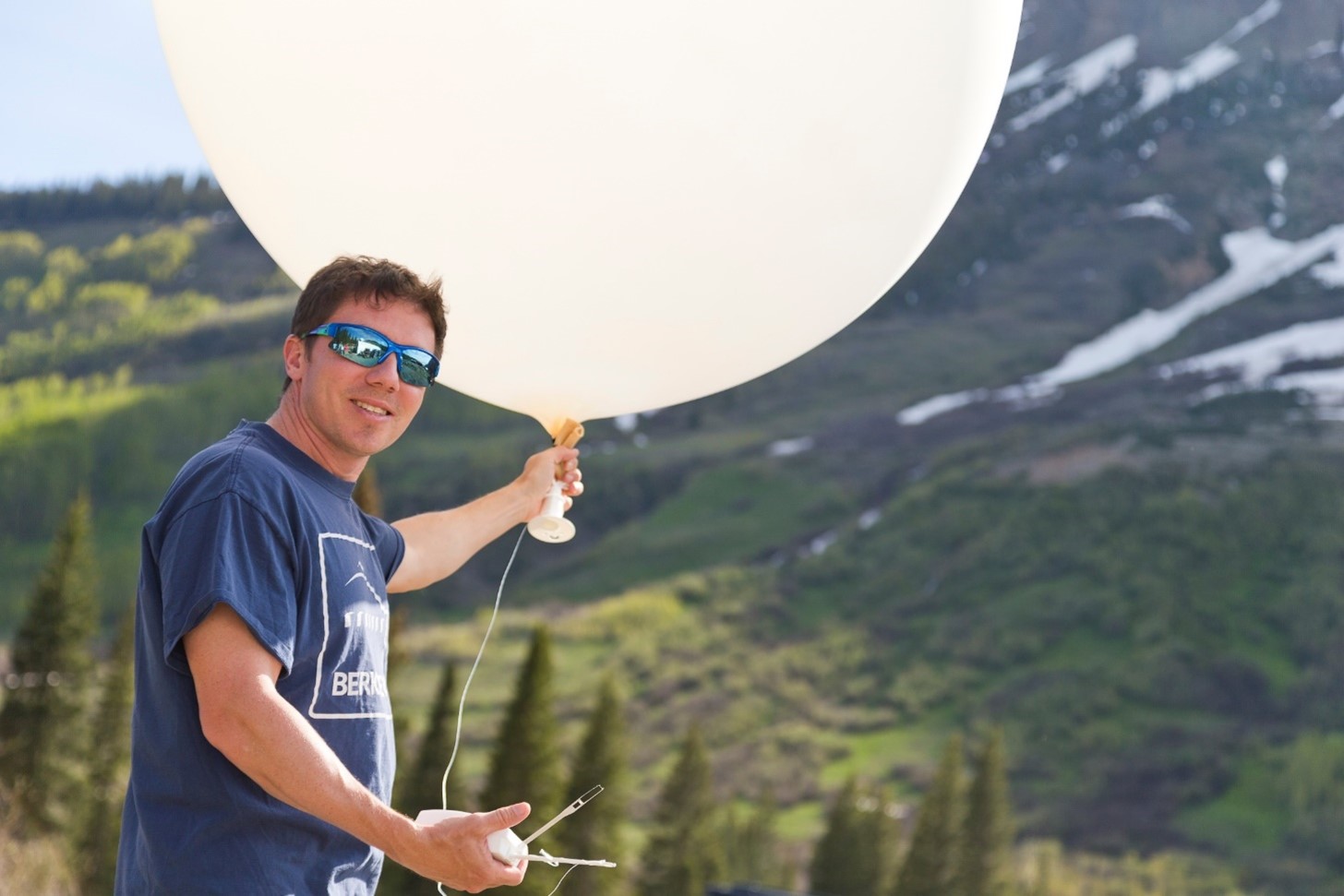
They were on their way to witness a few hours of one of SAIL’s last attempts at collecting data on mountain hydrology―serial launches of tethered balloon systems, which measure atmospheric conditions in a narrow vertical column about a half-mile above the surface. Working the whirring winches and guiding the whale-size balloons was a crew directed by Dari Dexheimer from Sandia National Laboratories in New Mexico.
After ending its nearly two-year observational phase in mid-June, SAIL is now in a new phase focused on data analysis, modeling, and emerging collaborations. But looking back is satisfying, says Feldman. “SAIL created what is the foremost data set for mountain hydrology in North America―and perhaps beyond. That’s really fantastic.”
The Atmosphere Over Complex Terrain
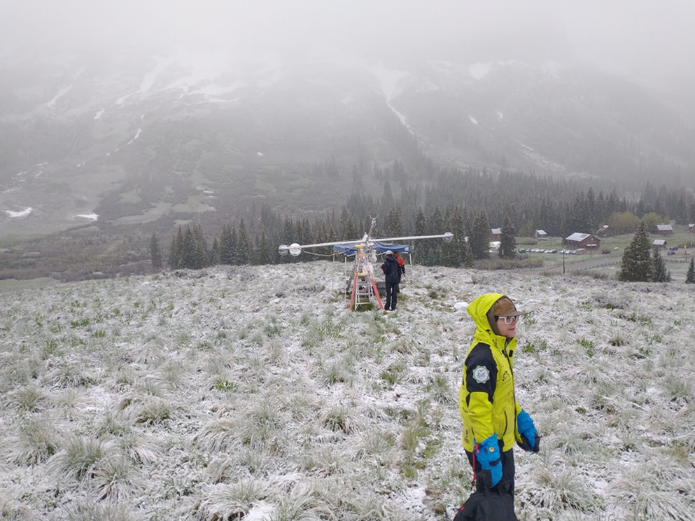
“The story of the atmosphere in the Upper Colorado River is a dramatic one,” says Feldman. SAIL required a critical mass of measurement technologies―the most ever, he says, arrayed to collect data on mountain hydrology in North America.
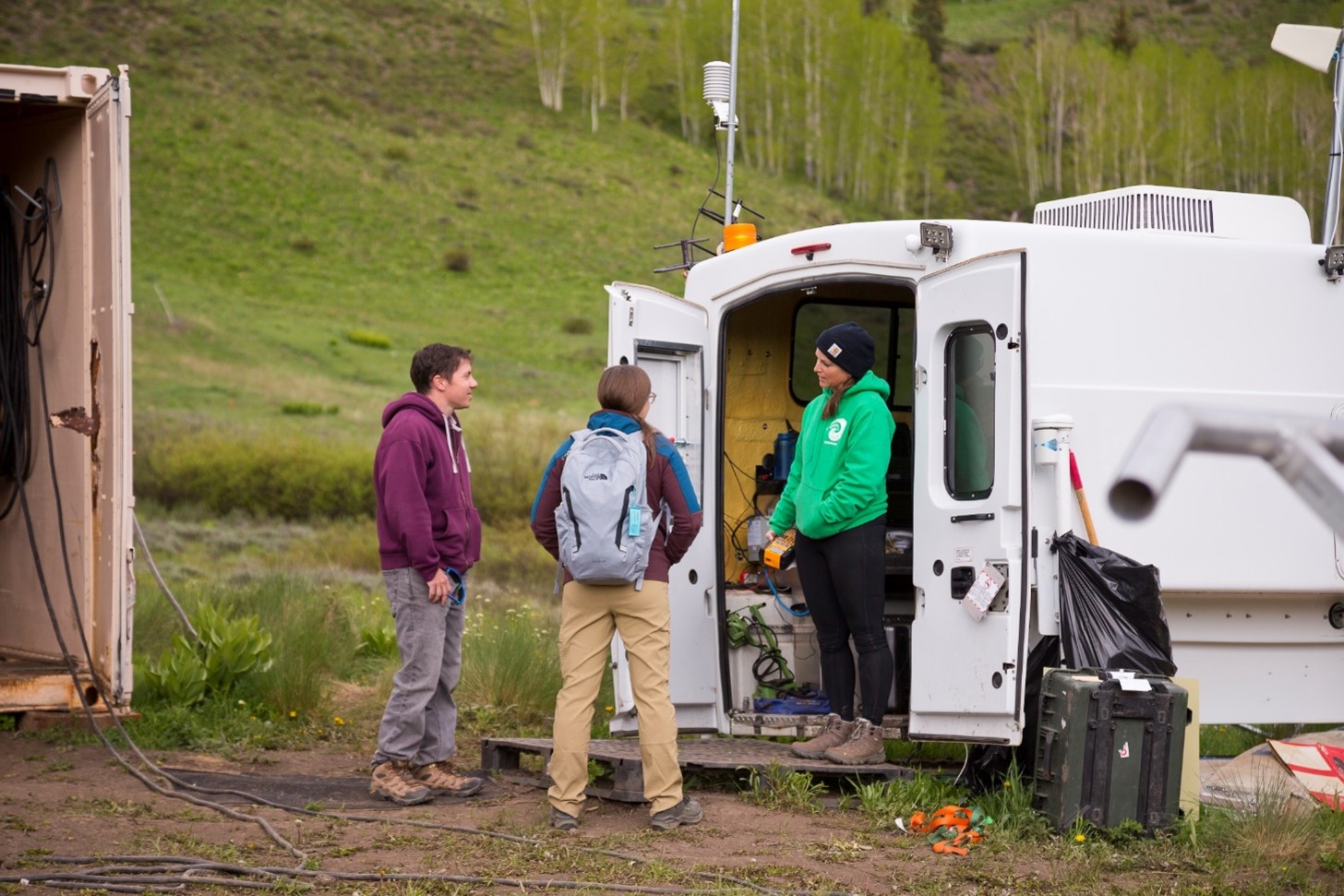
Core campaign instruments came from the U.S. Department of Energy’s (DOE) Atmospheric Radiation Measurement (ARM) user facility.
“New instrumentation for the SAIL campaign really took advantage of the fact that ARM is a national user facility,” says Feldman. “We were able to leverage that to great scientific effect.”
The same observations across seasons, he adds, will allow “a hard look at a wide range of models, from process models all the way up to, potentially, even earth systems models.”
It is challenging and complex, however, to observe processes and systems in mountainous terrain. SAIL promised to collect details on mountain hydrology from bedrock to atmosphere―as Feldman says, “all the ways the atmosphere and surface are interacting.”
(Warning: Pun ahead.)
Despite the terrain and the challenges of placing and powering instruments, Feldman says researchers and technicians “sailed through.”
Collectively, SAIL data “allow us to take a look at exactly how the atmosphere is functioning in complex terrain,” he says, careful to give credit to a lucky streak of changing conditions over SAIL’s 21 months of observations. The campaign stretched over two autumns, two winters, two springs, and one summer.
At the beginning of SAIL in September 2021, conditions were extremely dry―some say the worst in 1,000 years, explains Feldman.
After that, there were recoveries from drought, starting with a late December 2021 snowfall. It was so heavy (100 inches in a few days) that Coloradans remember it as the “Santa Slammer.”
Then came record monsoon rainfall in the summer of 2022. In all, right up to heavy snow that began 2023, SAIL researchers witnessed what Feldman calls many “opportunities to drill down into exactly how precipitation was forming, how much was forming, and why it was forming in different places. We captured (those deliveries of rain and snow) in quite explicit detail.”
High-Stakes Mountain Hydrology
Such details matter.
Almost two-thirds of Earth’s freshwater originates in mountain ranges, the so-called “water towers of the world.”
Within the Rockies, the East River Watershed is part of a mountain hydrology system that residents of seven Western states rely on downstream.
In the longer term, the data and models that will emerge from SAIL’s current phase will help scientists meet a trauma-like future possibility: Mountains are warming faster than land below. That could mean less snow and less snowmelt in the century ahead. Add to that alterations in the atmosphere that could shrink the volume of water getting downstream.
“The Upper Colorado River (watershed) is a very large area―100,000 square miles,” says Feldman, describing the bigger picture beyond the SAIL study area. “It’s totally unreasonable to try to measure everything everywhere.”
But it is reasonable, he adds, “to put on our thinking caps and extend what is learned during SAIL to other locations.”
The goal is that SAIL’s detailed measurements―atmospheric temperature, aerosols, trace gases, precipitation, solar and infrared energy, winds, soil moisture, and other factors―will be used in wider applications.
“The data and models that will emerge from the post-observation phase of SAIL will help scientists and planners prepare for a future that may have little resemblance to the past,” says Feldman.
SAIL Partnerships
Feldman is in conversation with SAIL’s sister campaigns and its research partners about “what the future might look like,” he says, including collaborations and instrumentation.
DOE’s Watershed Function Scientific Focus Area, a SAIL partner led by Berkeley Lab, had been taking surface and subsurface measurements for years before SAIL arrived and will continue afterward. The Study of Precipitation, the Lower Atmosphere and Surface for Hydrometeorology (SPLASH), a NOAA-funded SAIL partner from the beginning, will maintain its East River Watershed observation network through the end of summer 2023.
The Rocky Mountain Biological Laboratory in Gothic, in the heart of the study area, is a “key connection point and key area of support” for SAIL, says Feldman.
He also calls out “complementary and collaborative” sister campaigns, mainly SPLASH and Sublimation of Snow (SOS), a 30-week mountain hydrology research project at the University of Washington. SOS turned in its latest data in May 2023.
The Aspen Global Change Institute, an SOS partner in Colorado, will keep a hand in too.
“The partnerships were very powerful and very fun,” says Feldman. “They will enable us to work together moving forward.”
Such a wide, coordinated network of partners will also provide a logistical template for locating instruments in complex terrain, he says. So will the dozen or so smaller campaigns that deployed guest instruments in the SAIL study area.
Aiken led one of them: SAIL Supermicron Bioaerosol, which ran from April 2022 through June 2023.
Supermicron particles are larger than 1 micron in diameter. That’s large for an aerosol particle, but still 25 times smaller than anything the eye can see―and much smaller than a cloud droplet.
In mountainous terrain, the seasonal and day-night cycles of supermicron particles, including bioaerosols, are little known. During SAIL, Aiken and her team collected “real-time biological information from particles that fluoresce due to the presence of biological material,” she says―an attempt to investigate “the interaction of bioaerosol with meteorology such as precipitation.”
Other smaller campaigns are associated with projects funded by DOE’s Atmospheric System Research (ASR) program.
“A longer data record is a more complete data record,” says Feldman. “With the density of instruments we have, we’re about to evaluate gradients across much of the East River Watershed,” including in horizontal and vertical dimensions.
Coordinating instruments matters too. A prime example: SAIL and SPLASH X-band radars were often programmed to scan in tandem.
“You can think of it like synchronized swimming,” says Feldman. “You get more, you see more, with multiple instruments doing similar activities at the same time.”
‘Puzzle Pieces’
SAIL so far has chalked up more than 100 data sets, which are freely available from ARM’s Data Discovery. More will come online once SPLASH and SOS data are ready to publish.
“Because there is so much to see in the SAIL data, we look forward to working with the research community to get workflows set up and a critical mass (of data) going,” says Feldman.
He expects to see future insights on how the dominant components of the atmosphere affect mountain hydrology; how patterns in snowpack seem to echo patterns in atmospheric processes; how to track snowflakes from formation to evolution to landing on the surface; and how aerosols affect atmospheric radiation, precipitation, melting processes, and nutrients for mountain plant life.
Feldman recounts “an inspiring lesson throughout the campaign” as it moved from proposal to installations to data collection: “how many disciplines important to mountain hydrology are connected to atmospheric science. There are whole new worlds to explore with these data―more than I had imagined, every time I look.”
In sum, SAIL has created “a giant set of puzzle pieces,” he says, which when put together “will advance predictive understanding of water resources in the future.”
Models and Meetings in the Making
SAIL observations officially wrapped up June 15, but its puzzle pieces of data remain to be tapped. Models need to capture information on not just atmospheric and surface processes, but also how those processes work in tandem―and how they extend beyond the spatial and temporal footprint of SAIL.
In the modeling arena, experts at Berkeley Lab and elsewhere are using the traditional Weather Research and Forecasting model as a foundation for understanding and contextualizing SAIL data.
Other “ambitious sets of model development” are underway throughout the university ecosystem, says Feldman, “with more to come.”
Biweekly SAIL teleconferences that started in 2021 will continue. Speakers are already booked through October 2023. Past presentations covered SOS, SPLASH, snow-surface heat fluxes, aerosol data (including on wildfire influences), water vapor, snow darkening, blowing snow, and networked sensors.
Feldman plans a “science summit” on modeling for SAIL insiders (no date yet) as well as presentations during upcoming professional meetings: the 2023 Joint ARM User Facility/ASR Principal Investigators Meeting (August), the 2023 American Geophysical Union Fall Meeting (December), and the 2024 American Meteorological Society Annual Meeting (January).
For the ARM/ASR joint meeting, Feldman and Aiken are co-authoring SAIL-related posters and will join Gijs de Boer and Scott Collis in co-hosting a breakout session on SAIL, SPLASH, and SOS. Collis is a SAIL co-investigator, and de Boer leads SPLASH.
“We have an effort underway,” says Feldman of SAIL and its new data, which promise to produce “a burst of understanding. We’re looking forward to setting our ship on a tack that harnesses all of that understanding―and seeing where it takes us.”
# # #Author: Corydon Ireland, Science Writer, Pacific Northwest National Laboratory
This work was supported by the U.S. Department of Energy’s Office of Science, through the Biological and Environmental Research program as part of the Atmospheric System Research program.

