Data to Help Understanding of How Forests Affect Weather and Climate
If you are eager to start using the Atmospheric Radiation Measurement (ARM) user facility’s newest atmospheric observatory, your wait is just about over.
The Bankhead National Forest (BNF) observatory in northern Alabama will officially open October 1, 2024. Test data are now flowing from BNF instruments, signaling a key milestone along the path from observatory conception to operations.
With support from ARM, a U.S. Department of Energy (DOE) Office of Science user facility, and DOE’s Atmospheric System Research (ASR) program, a multi-institutional site science team developed the science plan and initial research project for the BNF. The team also created and applied science-driven siting criteria to identify the preferred region for the observatory.
For at least five years, the BNF will investigate the complex interactions among clouds, vegetation, and aerosols suspended in the atmosphere. By exploring critical feedback between these areas, the observatory will contribute valuable insights into aerosol-cloud interactions. The data collected will also advance weather and climate models for a more comprehensive understanding of Earth’s atmospheric dynamics.
Overall, BNF data will help scientists understand and improve numerical model simulations of the impacts of climate change on local weather patterns in the Southeastern United States and gain a better understanding of how forests influence both weather and climate.
“Our goal in selecting this site and the configuration of instruments is to enable studies from the canopy to the clouds,” said BNF site science team lead Chongai Kuang, an atmospheric scientist from DOE’s Brookhaven National Laboratory in New York. “We’ll be breaking new ground for interactive land-atmosphere studies by introducing state-of-the-art tower facilities, campaign-driven aerial assets, targeted intensive operational periods, and surface-distributed sites within the forested environment and over the larger domain around BNF.”
Research at the BNF will also help ARM and ASR accomplish their scientific missions.
ARM is a multi-laboratory user facility that provides continuous field measurements of atmospheric data from around the globe, serving as a key contributor to national and international climate research efforts. It works closely with ASR, which seeks to advance the process-level understanding of the key interactions among aerosols, clouds, precipitation, radiation, dynamics, and thermodynamics, with the ultimate goal of reducing the uncertainty in global and regional earth system models.
ARM operates three fixed-location observatories, as well as mobile and aerial observatories, in climate-critical regions of the world. The BNF is a long-term mobile observatory whose instruments previously operated in Oliktok Point, Alaska, from 2013 until 2021.
Collaboration Key to Opening
The past five years have been full of discussion and collaboration between DOE, ARM, ASR, national labs, and federal, state, and local agencies and organizations—right down to individual Alabama homeowners.
In 2019, DOE announced it would move the ARM mobile observatory in Oliktok Point to the Southeastern United States, which had been identified as a priority region of interest for further study by ARM. DOE put out a call for a national lab-led site science team to provide scientific input and guidance to ARM for the Southeastern U.S. deployment. Kuang’s team submitted the selected proposal.
The team began working with ARM staff at DOE’s Sandia National Laboratories in New Mexico, which coordinated the move of the mobile observatory out of Oliktok Point and many other people to identify potential study sites. The team gave many presentations at ARM/ASR science meetings and other scientific meetings to get input from the research community. Eventually, the group narrowed in on the Bankhead area. ARM submitted an application for a special use permit to the U.S. Forest Service (USFS) for the BNF site that was approved in December 2022.
“We are looking forward to bringing new colleagues from these institutions into our field. Not only will their excellent research expertise help, but their deep knowledge of local conditions and communities will be invaluable in analyzing the data from BNF.”
– Shaima Nasiri
“Our partnership with the USFS has been amazing,” says BNF Manager Mike Ritsche. “Their assistance, guidance, and knowledge of not only the Bankhead National Forest but the local area was critical to our success. This partnership will be instrumental during our deployment for the next five years.”
In late 2021, management of the mobile observatory was transitioned to DOE’s Argonne National Laboratory in Illinois, where Ritsche is based. ARM staff at Argonne have led logistics of BNF site preparation, construction, and equipment delivery and placement. They are also responsible for managing staff who are installing and maintaining equipment, overseeing day-to-day operations, and hosting visitors at the research sites.
The road to opening the BNF included some frustrating roadblocks—COVID, extreme weather, staff scheduling conflicts, long waits for safety and environmental approvals, and supply chain issues, to name a few—but progress was delayed, not denied.
Now, all involved are ready to see the science that is about to start emerging from the observatory.
“The complexities of the atmospheric system cannot be understood through isolated research efforts,” says Ritsche, who manages the BNF along with ARM’s Southern Great Plains observatory in Oklahoma. “Collaboration is critical, and we’re grateful to our partners for their support in establishing this state-of-the-art research facility.”
Sites and Instruments
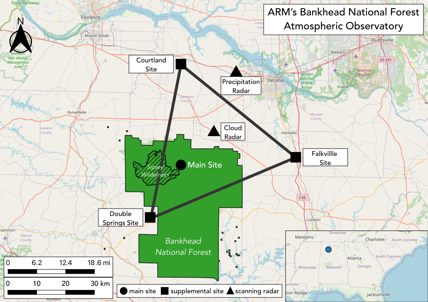
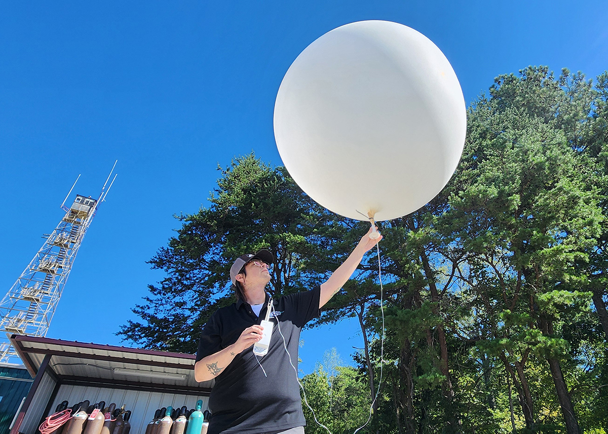
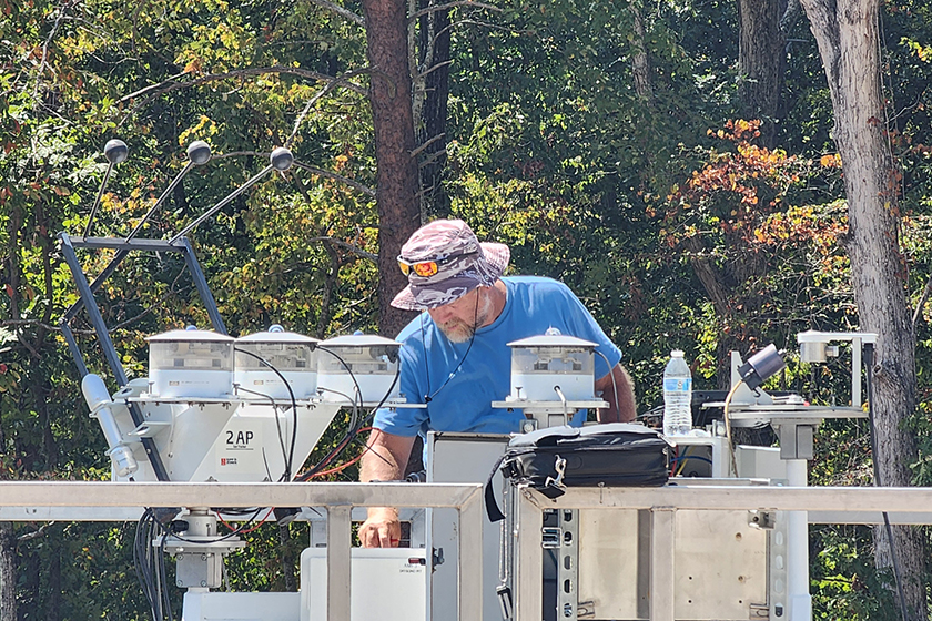
Within the forest, slightly southwest of the town of Moulton, the BNF’s main site includes lidars, radiometers, aerosol instrumentation, a vertically pointing radar, and a building with equipment for managing communications and data. An adjacent clearing the size of a football field is filled with instruments for monitoring clouds, precipitation, solar energy (sunlight and heat), and other atmospheric conditions. There is also a guest instrument facility to support visiting scientists.
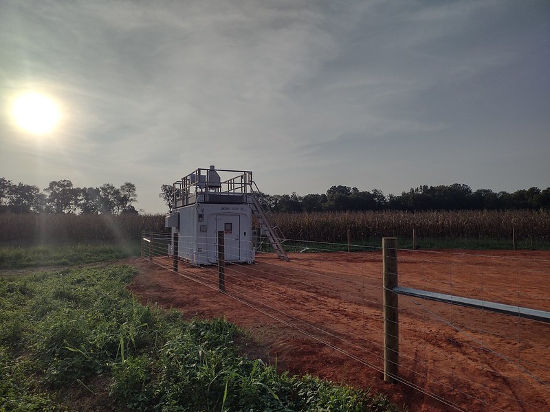
Three supplemental sites beyond the forest form a triangle around the main data collection area. These instrumented sites—located at Courtland, Double Springs, and Falkville—are positioned about 30 miles (50 kilometers) from one another. Measurements of temperature, water vapor, air motion, and land surface properties from the supplemental sites will provide regional context for the data coming in from the main site.
Over the next several months, even more BNF instruments will come online.
Just over half a mile (1 kilometer) away from the main site, a 140-foot (43-meter) walk-up tower is scheduled for installation in November. In collaboration with DOE’s AmeriFlux program, ARM will outfit the tower with instruments to measure detailed characteristics of the forest ‘splants, air motions, and soil.
Additional ARM instruments on the tower will measure the vertical profile of trace gases, pollen, and other aerosols and aerosol precursor gases released by plants in the forest. Smaller towers installed closer to the forest floor will measure many of these same variables at ground level, along with temperature, humidity, air motion, and soil properties.
“We are looking forward to the new scientific opportunities that the BNF site will bring,” says DOE ARM Program Manager Sally McFarlane. “This location was chosen for the AMF (ARM Mobile Facility) deployment because of the vast range of scientific questions, and the interest in collaboration across DOE research programs to address these cross-cutting questions.”
Outside the forest, two additional sites beginning construction now will host scanning radars: a Ka/X-band cloud radar and a C-band precipitation radar. The radars will observe clouds and precipitation above the main research area and surrounding region.
“It’s exciting to see the observatory come to life, and we look forward to the insights our data will provide into aerosol-cloud interactions and local weather patterns in the Southeastern U.S. region,” says Ritsche.
How to Use BNF Data
BNF data will be available to the international research community in near-real time at no cost through the ARM Data Center. ARM staff will also analyze and apply algorithms to BNF data to create higher-order, or value-added, products that can be used in atmospheric research and global climate models.
For scientists eager to start fieldwork, ARM expects to be able to accommodate guest instrumentation in November 2024 at the earliest. Guest instrument deployments require an ARM field campaign proposal. Because research activities at the BNF might also need USFS approval, ARM encourages scientists to plan ahead and submit requests early for any potential guest instrument activities. More information is available in Appendix E of the ARM Field Campaign Guidelines.
Researchers are already lining up to use the observatory. ASR has funded an initial set of BNF research projects. A set of collaborative projects with the Environmental Molecular Sciences Laboratory (EMSL), another DOE Office of Science user facility, will use samples collected on ARM’s tethered balloon system and EMSL’s advanced laboratory instrumentation to study biological aerosols, secondary organic aerosols, and ice-nucleating particles. Also, DOE’s Early Career Research Program will support a trio of university and national lab scientists planning to work on five-year projects using BNF data.
The BNF site science team is also reaching out to universities in the region, including minority-serving institutions and Historically Black Colleges and Universities (HBCUs). Promising relationships have formed with the University of Alabama in Huntsville (UAH) and with Alabama A&M University, which has the only professionally accredited forestry program at an HBCU.
A science kickoff meeting is tentatively being planned for December at UAH. The meeting will bring together local universities, agencies, measurement networks, and science partners to learn more about ARM and the BNF and to develop collaborations.
“We are looking forward to bringing new colleagues from these institutions into our field. Not only will their excellent research expertise help, but their deep knowledge of local conditions and communities will be invaluable in analyzing the data from BNF,” says ASR Program Manager Shaima Nasiri.
Argonne and Brookhaven national laboratories contributed text to this article.
# # #This work was supported by the U.S. Department of Energy’s Office of Science, through the Biological and Environmental Research program as part of the Atmospheric System Research program.