For nearly a decade, one lab project has dug into the details of the hard-to-predict boundary layer
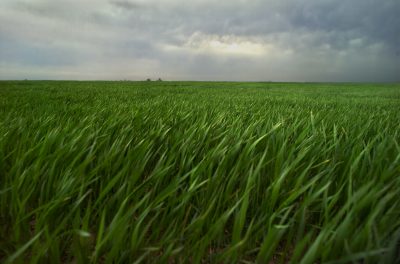
We all experience weather—the rain, wind, and sliding temperatures that color our daily lives. Our weather happens in the boundary layer, the lowest few kilometers of Earth’s atmosphere.
Since 2009, the boundary layer and its clouds, precipitation, and patterns of radiation have been under the lens of a Science Focus Area (SFA) project at Lawrence Livermore National Laboratory (LLNL) funded by the Atmospheric System Research (ASR) program at the U.S. Department of Energy (DOE).
The SFA’s researchers investigate how low clouds over both land and ocean behave; evaluate how well current models are representing such clouds and their interactions with the surface compared to observational data; and create diagnostic tools that improve model performance.
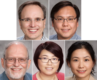
Compared to similar efforts at other national laboratories, “we’re small,” Stephen Klein says of his five-member project, which is a distinct evaluation arm of a larger SFA at DOE that is jointly funded with the Regional and Global Modeling program.
But the SFA is also unique, he says, since “we have been involved with modelers from the beginning.”
The members of the Livermore ASR SFA, as they call themselves, are not on the front lines of making models, he says, but provide services to those who are. They study in a fundamental way how clouds, the boundary layer, and the surface of the land function in nature; test how well various models agree with observations; and provide critiques of how well clouds are represented.
The SFA is unique in another way. “We are distinct by an absence,” says Klein, since there is no focus on aerosols or atmospheric chemistry, as larger SFAs have. “We are focused on the physical processes of low clouds and the interaction of the atmosphere with the land, and how well they are represented in models designed to simulate future conditions.”
‘Struggling to Get Clouds Right’
Low, warm clouds over the ocean, for one, says SFA member Xue Zheng, reflect a lot of solar radiation and cover immense tracts of the sky, making them “a very important component of the whole climate system” and the one most responsible for variations in the Earth’s energy budget.

Over land, low clouds are important too. They help determine how hot or cold it gets, how moist or dry soils are, and how much precipitation there is.
“Yet even state-of-the-art models are struggling to get those clouds right,” says Zheng, an oceanic clouds specialist. Meanwhile, she adds, the modeling science community is riven with disagreements over how to represent them.
Zheng only works half time on the SFA. She spends the other half of her days in the world of modelers themselves. Currently, she is focused on the Community Atmosphere Model (CAM) and gearing up to have a role in developing and testing DOE’s recently introduced Energy Exascale Earth System Model (E3SM).
To the modeling community, the SFA is to be both a diagnostic guide, says Zheng, and a source of ways to implement improvements in the models by testing them against observations, which are largely from the Atmospheric Radiation Measurement (ARM) Climate Research Facility, a DOE scientific user facility.
Some of Zheng’s recent work was used to influence choices in how to represent low-cloud processes in models.
Says Klein of his team: “We influence decisions. We don’t just write papers.”
Division of SFA Labor
As project leader, Klein maintains a science vision for the SFA, guiding the project and evaluating the work of other team members.
Yunyan Zhang specializes in shallow convection over land and its transition to the deep convection rain events that give us towering thunderheads and storms. The 2015 DOE Early Career Research Program grantee does observational work as well as work modeling the life cycle of clouds in the boundary layer.
Thomas Phillips, an atmospheric research scientist at LLNL’s Program for Climate Model Diagnosis and Intercomparison, studies land-atmosphere dynamics. He also analyzes ground-observation data along with how well models represent land-atmosphere interactions. Like Zhang, Phillips uses copious data from the ARM Facility’s Southern Great Plains atmospheric observatory.
Team member Hsi-Yen Ma generates new simulations, and he evaluates the performance of cloud precipitation and radiation simulations in earth system models, using a numerical weather system approach.
That illustrates another feature of the SFA that makes it unique. Models are usually evaluated on the basis of a climate simulation run to predict conditions over decades, or even hundreds of years.
Ma says, “We take the same models and run them like a weather forecasting center does,” generating a series of forecasts over a few days or more.
With parameterizations of cloud precipitation and radiation in the spotlight, says Ma, short-term simulations like these “can get you a very robust picture of these processes” and in turn test their performance in models.
So far, such short-term simulations run at a weather center scale—“very close to the reality of the world,” says Ma, and inexpensive to do—seem to be an accurate proxy for making better simulations on a longer scale. “When you improve these processes on a short-term scale, you can see improvement in the longer scale.”
At the same time, the weather forecasting model approach allows you to see “how the model shifts from reality to the model world,” says Ma. Those are the crossover points at which simulations begin to diverge from the way nature actually performs in the realm of clouds, precipitation, and radiation.
No one gets muddy boots or a wet hat doing models. “That’s another thing that makes us unique,” says Klein of his SFA team. “We are not observationalists. We are not out in the field.”
Consequential Land and Sea
At the same time, says Zheng, “we use ARM data to guide our findings,” since modelers both inform and test models by comparing it to observational data.
Her work so far has drawn most heavily on data from two sources: Clouds, Aerosols, and Precipitation in the Marine Boundary Layer (CAP-MBL), a 19-month, intensive 2009-2010 field campaign in the Azores that deployed an ARM mobile facility, and Marine ARM GPCI Investigation of Clouds (MAGIC), a 2012-2013 campaign that deployed an ARM mobile facility aboard a cargo ship traversing the Pacific Ocean.
Next, Zheng is now in conversation to tap into data from Aerosol and Cloud Experiments in the Eastern North Atlantic (ACE-ENA), an ARM field campaign that took place in summer (June and July) 2017 and winter (January and February) 2018.
The SFA looks at data from land as well as the sea.
Phillips, the land-atmosphere interactions expert, uses ARM data from the SGP observatory to test how well models represent conditions in the boundary layer and on the near-surface of the Earth—the first 2 meters of the atmosphere.
He studies how land properties such as soil moisture and vegetation are coupled with atmospheric variables at the near-surface, such as surface temperature, relative humidity, and turbulent fluxes in latent and sensible heat.
Phillips also analyzes how well CAM represents the coupling of land properties with lower-atmosphere variables, using ARM data as the verification reference.
It turns out there are glitches.
For one, he says, “in CAM the coupling between soil moisture and surface atmospheric variables is much stronger than in ARM observations.” That is, the model exaggerates the impact of soil moisture on the surface variables, such as temperature.
In a related model-nature mismatch, SFA researchers, including Ma and Klein, helped author a four-paper series earlier this year in Journal of Geophysical Research, delving into the fact that most climate models have a summertime “warm bias”—that is, they consistently predict higher surface temperatures than nature (by way of ARM observations) would suggest.
The articles are part of a DOE model intercomparison project called Clouds Above the United States and Errors at the Surface (CAUSES), featured most recently at the 2018 ARM/ASR joint meeting.
At Livermore, within the SFA, “We continually go back to ARM data to ask: Where is the model going wrong?” says Phillips. “The end goal is to try and point out something about the model’s physics that is unrealistic.”
That will take a while, he adds. Meanwhile, models will get better as they are tweaked and critiqued by the kind of investigations done through the SFA.
That’s the goal, says Phillips: “to improve the models and make them more realistic.”
# # #
This work was supported by the U.S. Department of Energy’s Office of Science, Office of Biological and Environmental Research as part of the Atmospheric System Research Program.