In 2020, scientists are busy grappling with a high-quality, comprehensive dataset on cold-air outbreaks in northern Norway
COMBLE is over, but its rich data will now begin to take life.
That ear-pleasing acronym stands for Cold-Air Outbreaks in the Marine Boundary Layer Experiment (COMBLE), a field campaign that is part of the 2018-2021 project funded by the Atmospheric System Research (ASR) program at the U.S. Department of Energy (DOE).
The project is a broad study of mixed-phase clouds in the polar marine boundary layer. (Such clouds are made of both liquid and ice.)
COMBLE, supported by experts and instruments from DOE’s Atmospheric Radiation Measurement (ARM) user facility, was led by University of Wyoming atmospheric scientist Bart Geerts. This year, he is busy coordinating the next steps for what he calls a “quite exciting” dataset.
Geerts sees COMBLE as “a great leap forward” for scientists investigating the Arctic.
Twenty international collaborators formulated COMBLE’s science plan. The field campaign’s mission was to study cold-air outbreaks (CAOs) in the marine boundary layer. CAOs are important but little-understood atmospheric processes.
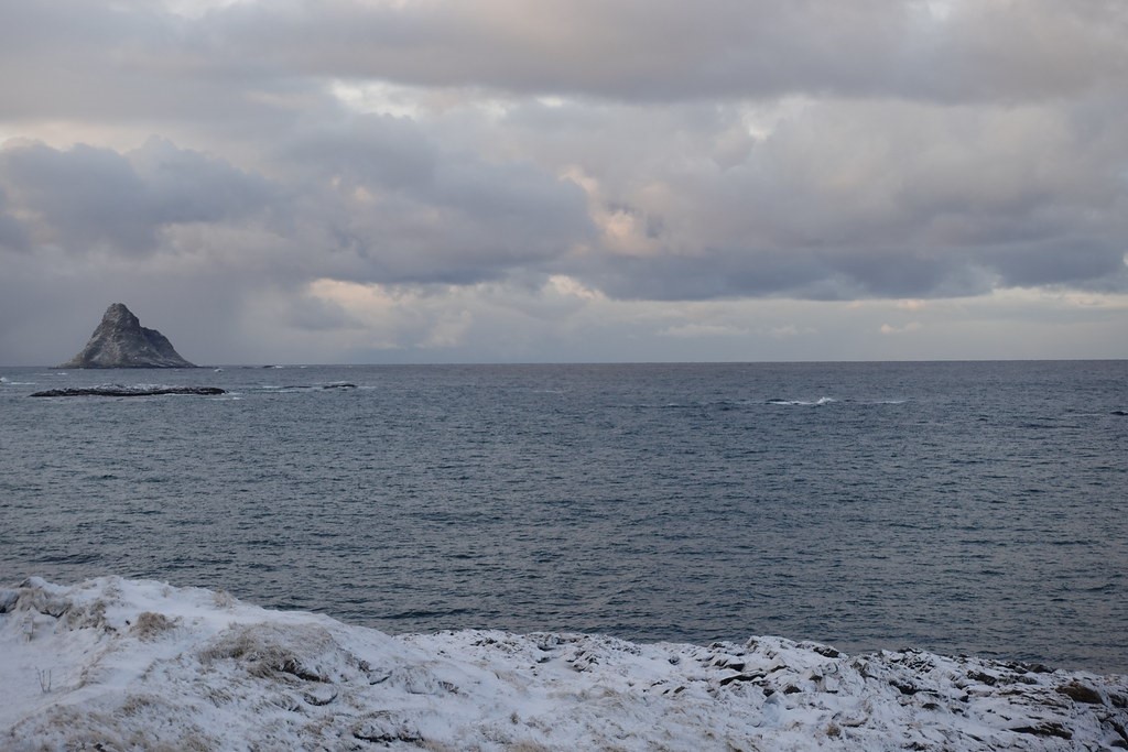
The campaign’s outdoor laboratory was a vast stretch of open water in the Norwegian Sea.
“We wanted to sample the Arctic airmass,” says Geerts, one that was “modified by this relatively warm sea, on the downwind shore as far north as we could go in Scandinavia.”
Across Open Water
A cold-air outbreak happens when a mass of cold air from an edge of polar ice sweeps across an open area of warm water. Among other things, CAOs prompt the formation of shallow convective clouds, which then grow and evolve into a characteristic cloud regime that plays a key role in the Earth’s energy balance.
Shallow low clouds over the oceans have been extensively studied. However, little is known about the properties of such clouds formed during CAOs or about related processes within the boundary layer. Central science questions include: What controls the macrostructure of this cloud regime? What is the liquid/ice phase distribution in these clouds? And what is the role of cloud-active aerosols?
COMBLE will narrow those knowledge gaps.
The campaign started a month earlier than planned, in December 2019, and finished in late May 2020. It was on time, logistically smooth despite rough weather conditions, and took quality CAO-related measurements over a longer time period than ever done before.
“We’re very pleased to have the (CAO) data set,” says Geerts. “This is the first time such a high-quality, comprehensive data set has been collected.”
‘A Hot Spot’
Geerts says previous CAO studies were brief and relied on just a few aircraft measurements.
COMBLE, on the other hand, has the duration, completeness, and focus on observing marine CAO cloud regimes that occur predominantly in winter and early spring off the large boreal continents and ice sheets in the Arctic. It also helps that CAOs have been observed in other recent campaigns, including the ARM-supported Measurements of Aerosols, Radiation, and Clouds over the Southern Ocean (MARCUS) campaign.
Researchers have also sampled CAO cloud regimes at ARM’s North Slope of Alaska atmospheric observatory in Barrow (known officially as Utqiaġvik)―“but only for a short period in fall before the Arctic Sea ice covers the open water,” says Geerts.
He calls the Arctic Ocean in the North Atlantic, off the coast of Norway, “a hot spot for these cold-air outbreaks and clouds that develop over relatively warm water.”
During the campaign, researchers focused on shallow cloud processes over open water during CAOs. They were also on the lookout for other atmospheric phenomena, including air-sea exchange, cloud-organization patterns, the role of aerosols and surface environments, and the impact of CAOs on atmospheric and ocean circulation.
The backdrop for such research is dramatic: Temperatures in both the Arctic and neighboring boreal regions are rising twice as fast as the rest of the globe, a phenomenon known as arctic amplification. Boreal regions, mostly forest and bogs, trace a green line around the Arctic and include large areas of Russia, Scandinavia, and Canada.
An Early Start
To pull in the best CAO data, Geerts and his science-plan collaborators put the right instruments in the right places.
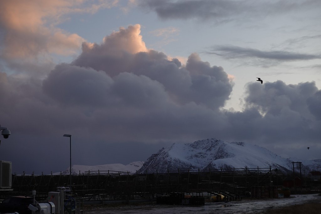
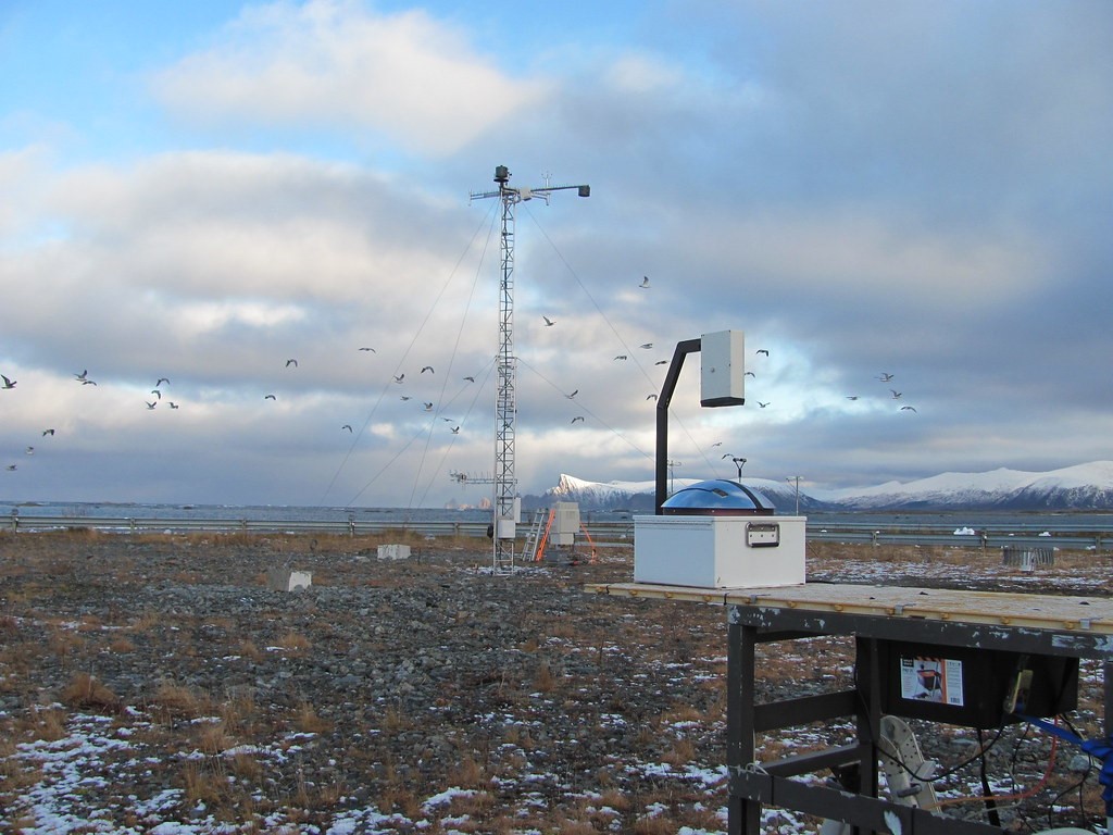
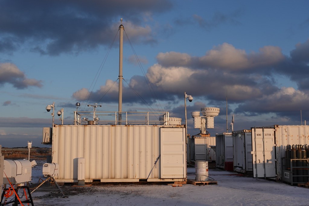
In the fall of 2019, ARM technicians set up the first ARM Mobile Facility (AMF1) in Nordmela, Norway, a fishing village within the Arctic Circle on the island of Andøya. The ice-bordered edge of the Arctic Ocean is approximately 1,000 kilometers (620 miles) away.
A secondary observational site, not as heavily instrumented, was on Bear Island, which is typically no more than 500 kilometers (310 miles) from the ice, which shrinks and advances.
There were challenges getting to Norway. AMF1 had to be packed up after its role during ARM’s 2018–2019 Cloud, Aerosol, and Complex Terrain Interactions (CACTI) field campaign in Argentina. Then its seagoing containers had to be shipped, sited on Andøya, and tested before data collection could begin.
Even so, says Geerts, “COMBLE started a month before we intended,” and its instruments hummed with precision―notwithstanding a few breakdowns in harsh conditions “and the occasional polar bear visits on Bear Island.”
Instruments collected data on aerosols, trace gases, surface fluxes, and basic meteorological information. COMBLE also profiled the lower atmosphere with passive microwave radiometers and ceilometers. Some of its radar and lidar instruments measured upwards, and its Ka- and W-band radars scanned the skies for broader measurement ranges.
Coming Research
At a meeting in the summer of 2020, says Geerts, a core of experts discussed how to proceed with “data analysis and modeling efforts at various scales.”
Meanwhile, he adds, “many are willing and ready” to do COMBLE research.
Some of the research will combine the prescient synergy of COMBLE with the concurrent 2019–2020 Multidisciplinary Drifting Observatory for the Study of Arctic Climate (MOSAiC) expedition. MOSAiC set sail from Tromsø, Norway, in September 2019 and is doing most of its work much further north from COMBLE and for twice as long. Its main observatory, locked into ice for much of the time, is arrayed aboard the German research icebreaker R/V Polarstern.
Geerts has called the two campaigns “quite coupled,” though they differ in scale and funding sources. MOSAiC will measure warm-air intrusions into the Arctic and the movement of clouds over ice. COMBLE measured cold air moving across open warm water and its convective consequences.
He identified two cases, both in March, which captured atmospheric flow data from the Polarstern, through the Fram Strait, and southward across the Norwegian Sea to the AMF1 site.
“These (MOSAiC) upstream measurements from 1,200 kilometers (745 miles) away from Andøya can be used to better constrain modeling efforts,” says Geerts. “All that can be used to drive models at a fairly large scale.”
Next, Please
In July 2020, ASR awarded $19 million to 31 research projects. Among them was one led by Geerts on numerical simulations of cold air outbreaks using COMBLE data in a multi-scale modeling framework.
Moreover, he plans to work with the National Center for Atmospheric Research in Colorado (and others) to capture COMBLE CAO clouds in large-eddy simulations that span the entire Norwegian Sea.
Geerts will also analyze observations for a few “golden cases” of CAO clouds impacting the AMF1 site, which will help modeling groups with the validation of the same cases.
That way, “comprehensive intercomparisons” are possible, he says. “Modelers really need to capture the effect of these heat fluxes, boundary-layer developments, and cloud processes in order to capture the impact of CAOs on the climate system. That’s ultimately what this is all about.”
# # #This work was supported by the U.S. Department of Energy’s Office of Science, through the Biological and Environmental Research program as part of the Atmospheric System Research program.