A data-rich study of cloud evolution in the Norwegian Sea marine boundary layer is the Focus of multiple modeling efforts
A year ago this month, the last few bytes of data flowed into computers at the end of what researchers have called the most sustained, best-instrumented look at marine cold-air outbreaks. What scientists call CAOs occur when a mass of cold air streaming from an edge of polar ice sweeps across an open area of relatively warm water.
The field campaign that collected those rich data was named after the phenomenon itself: Cold-Air Outbreaks in the Marine Boundary Layer Experiment (COMBLE).
COMBLE is part of a 2018–2021 project funded by the Atmospheric System Research (ASR) program within the U.S. Department of Energy (DOE). The Atmospheric Radiation Measurement (ARM) user facility conducted COMBLE from December 2019 through May 2020 in northern Norway.
Leading the multinational effort was University of Wyoming atmospheric scientist Bart Geerts. He is still coordinating all the ways six months of COMBLE data can be swung into action on behalf of science.
(Browse the ARM Data Center for available COMBLE data.)
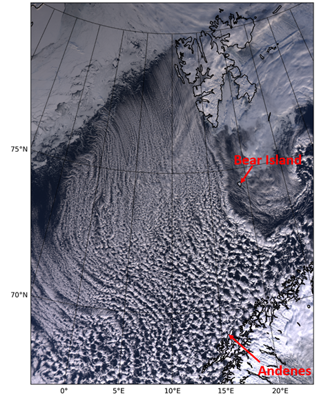
Starting at the edge of vast ice sheets or cold continents around the world, CAOs prompt the formation of shallow convective clouds in the polar marine boundary layer.
These mixed-phase clouds, made of both liquid and ice, begin as distinctive, streak-like “cloud streets.” From these evolve broader, less regularly spaced, open or closed cell patterns.
The resulting cloud regime plays a key role in the Earth’s energy balance. Regionally, the same cloud regime can dramatically alter local energy budgets.
The Dark of Polar Night
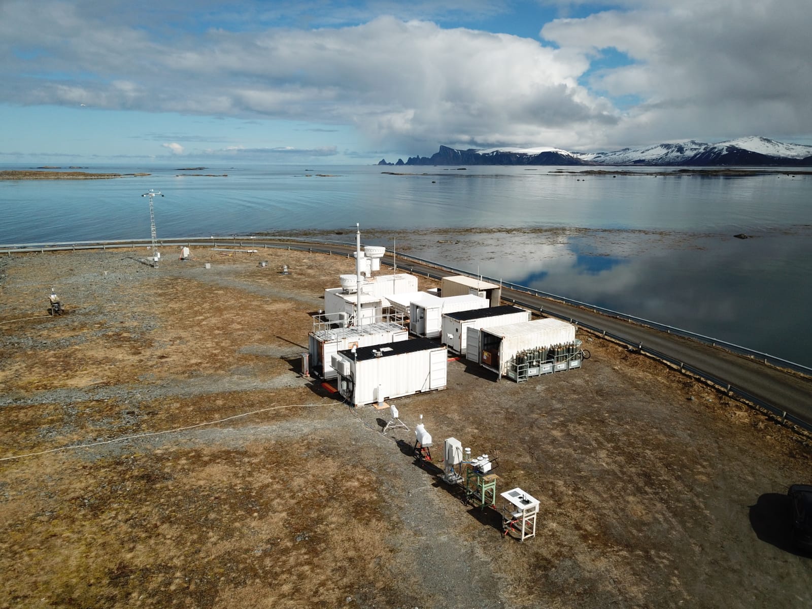
For COMBLE, ARM installed instruments at two island sites.
“I am still in awe over how the DOE personnel in charge of deploying the first ARM Mobile Facility (AMF1) managed to pull it off,” says Geerts. “This deployment was highly successful, and all instruments were operational at least one month ahead of schedule.”
Consider, too, the geographic and logistical challenges.
“This was done in the dark of the polar night,” says Geerts, “less than six months after completion of another AMF1 deployment in the Southern Hemisphere.”
And then in the middle of the campaign, in March 2020, at the season’s most critical time for observing CAOs, the COVID-19 pandemic was declared.
“While everything else shut down,” says Geerts, “DOE personnel managed to keep COMBLE going, through diplomatic efforts and engagement with the local community. Fishermen would come out to plow the access road or launch balloons. My hat is off to all those involved. It makes me appreciate this rich COMBLE data set even more.”
‘New Kid on the Block’
Maritime outbreaks of cold air, such as those that blast along hundreds of kilometers of the Norwegian Sea, chilled by ice formations to the north, can transform a moving air mass very quickly. Heat fluxes, spurred by the relatively warm water, rapidly create a well-mixed boundary layer.
“Surface heating―sensible heat flux―is out the roof,” says Geerts. This heating sometimes approaches 1,000 watts per square meter. That’s roughly three times the solar constant. (The solar constant is the average top-of-the-atmosphere solar irradiance at any point on earth.)
Cold-air mass characteristics can last for days over the Arctic ice sheet or over land. But they last just hours over expanses of relatively warm ocean water. That’s because high sensible and latent heat fluxes cause a convective layer of clouds to bubble into the lower atmosphere, swelling cloud heights from a couple hundred meters to nearly 5 kilometers (3.1 miles).
Over the Norwegian Sea, all this happens across approximately 1,000 kilometers (620 miles) of “fetch,” which refers to the distance upstream of a measurement site. In this particular fetch, air masses flow unimpeded over the open ocean and are modified due to surface heating.
This fetch creates cloud formations that look like deep convection. But the signature lightning of deep convection is absent; so are the usual cloud heights of such formations―up to 15 kilometers (9.3 miles).
Still, says Geerts, “the vertical motions we see in these cells at the AMF1 site are convective.” These motions include rapid updrafts and hydrometeors—ice and water particles—propelled to the cloud tops.
“We don’t know how these thunderstorm-like clouds evolve,” adds Geerts, “and we don’t know about their life cycles. They are sort of the new kid on the block.”
Theoretical constructs about deep and shallow convection help modelers put things in perspective, but CAO-related clouds fall somewhere in between the deep and shallow norms.
If you add in the effect of wind shear low in the atmosphere, CAO-created clouds become “a very interesting area of study,” says Geerts.
A First-Time Look
To date, marine CAO clouds are not well reflected in earth system models, partly because of the small size of the clouds and their circulations, and partly because in situ CAO data are scarce. Many field studies in the hostile environments that create CAOs have failed to provide much insight into the microphysics of their clouds.
COMBLE data promise to close gaps in what scientists know about the properties of CAO-formed clouds and their processes within affected boundary layers.
The data will also help researchers interpret decades of interesting satellite imagery. Such images will have more meaning when paired with the field campaign’s sustained ground observations, which Geerts calls “really revealing.”
To top it all off, he adds, “This is the first time we are looking in detail at these convective cells.”
Farsighted Observation Sites
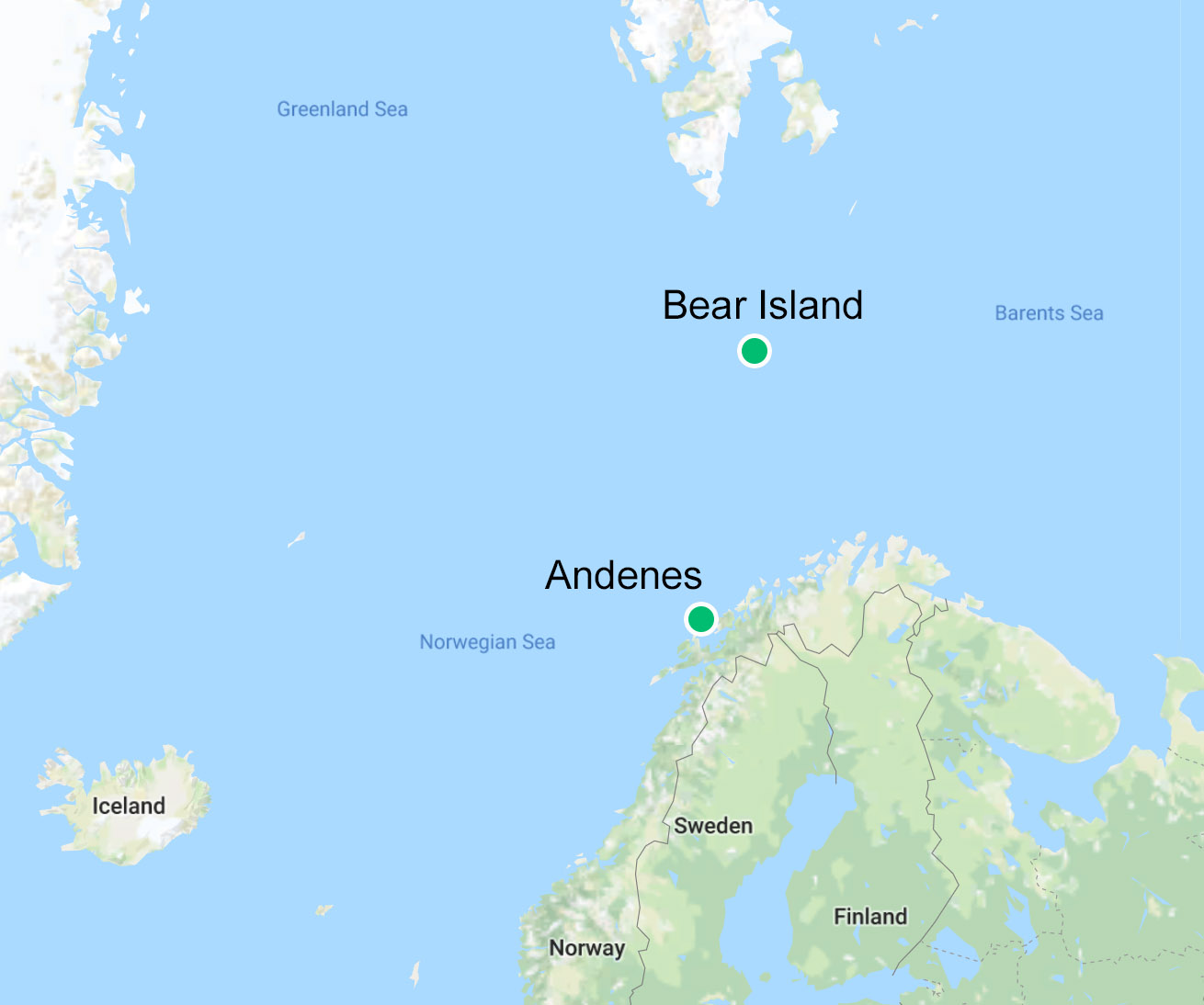
AMF1 pulled in COMBLE data from Nordmela, Norway, a small fishing village within the Arctic Circle on the island of Andøya, just off the Scandinavian mainland. The ice-bordered edge of the Arctic Ocean is approximately 1,000 kilometers (620 miles) to the north.
“While everything else shut down, DOE personnel managed to keep COMBLE going, through diplomatic efforts and engagement with the local community. Fishermen would come out to plow the access road or launch balloons. My hat is off to all those involved. It makes me appreciate this rich COMBLE data set even more.” – Bart Geerts
A smaller set of ARM instruments operated on Bear Island, a nearly uninhabited Norwegian island with no port. It lies at 75 degrees north latitude, some 500 kilometers (310 miles) north of the mainland.
“Equipping that site with ARM probes was another feat of logistical prowess,” says Geerts.
“Again, my hat is off to the DOE logistics and instrument deployment personnel. They worked intensively with the Norwegian meteorological service and the Norwegian coast guard to get there, by ship and by skiff.”
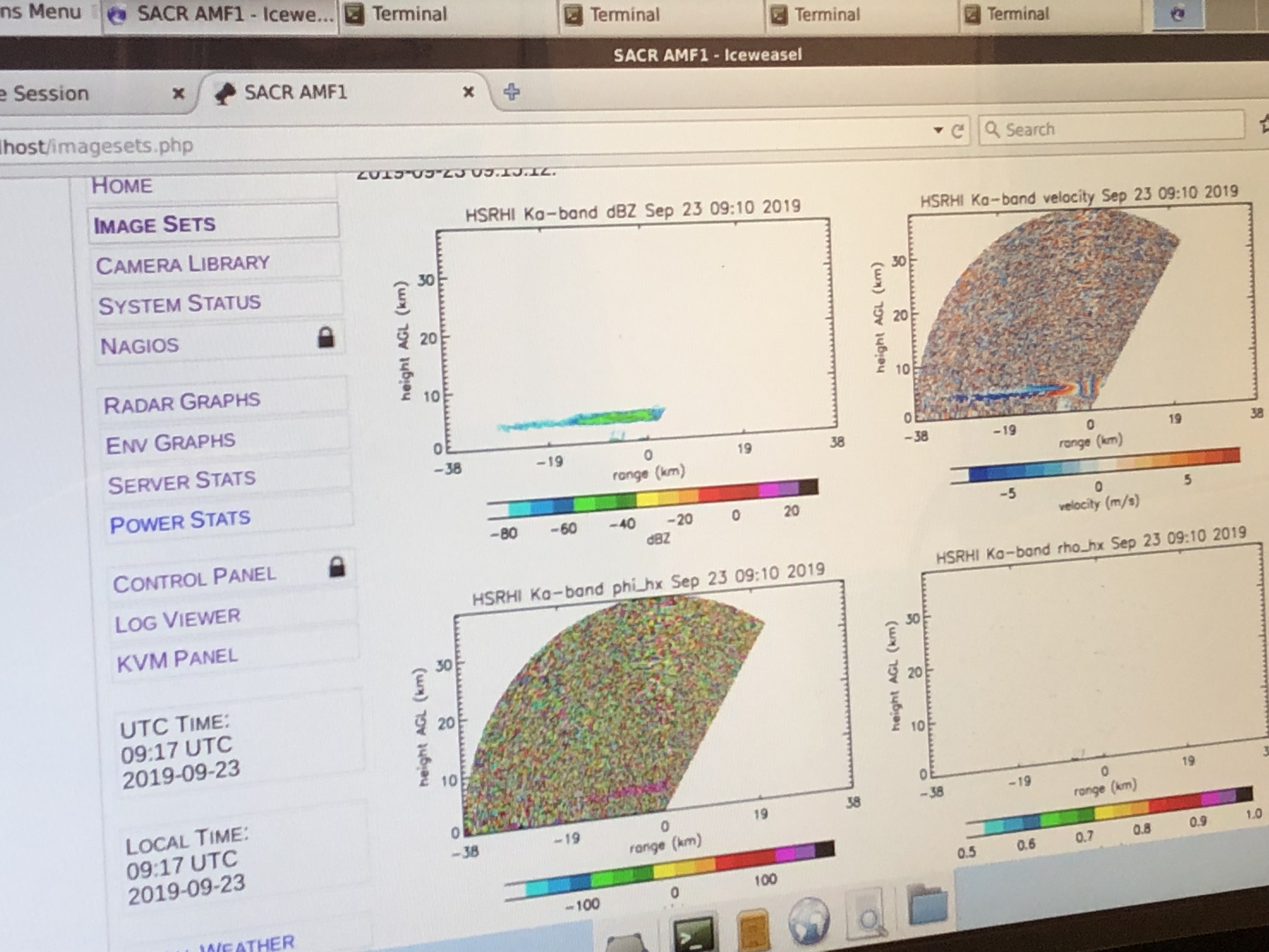
Instruments at both sites sampled the arctic air mass within vast stretches of the relatively warm Norwegian Sea. The in situ and remote-sensing ARM observations were mostly related to clouds, precipitation, and aerosols, including ice-nucleating particles.
Aerosols are ultrafine liquid and solid particles that influence cloud formation and atmospheric radiation. They sway how sunlight is either absorbed or scattered back into space.
Busy Modelers
All these data, says Geerts, prompted “a significant modeling component” following the COMBLE field campaign. Efforts are underway to simulate CAO behavior in a hierarchy of models, from single-column models and simulations of regional air turbulence to global earth system models.
“We are still very early” in the effort to harness the campaign data’s simulation potential, he adds. “Several (modeling projects) are trying to describe what is being described on the ground.”
Those projects include a group at the National Center for Atmospheric Research (NCAR) in Colorado led by Branko Kosovic, an expert in simulating boundary-layer flows.
Another modeling effort at Pacific Northwest National Laboratory in Washington state is directed by Mikhail Ovchinnikov, a regional and cloud modeling scientist. In 2020, he delivered a virtual presentation on the challenges and opportunities of developing COMBLE simulations.
The chief modeling challenge of COMBLE, says Geerts, is finding a high-resolution way to represent 1,000 kilometers of convective activity as it evolves from streak-like cloud streets near the ice edge to somewhat deep convective clouds near the AMF1 site. This must happen at a resolution sufficient to capture cloud processes and associated air flows.
Collaborations Brewing
There are extra challenges to modeling the microphysics of CAO conditions compared with those of other mixed-phase shallow clouds.
Such potential impediments were the subject of an ASR presentation delivered in 2017 by scientist Ann Fridlind, who is at the NASA Goddard Institute for Space Studies in New York. She leads ARM’s Cloud and Precipitation Measurements and Science Group.
Fridlind’s talk foreshadowed the challenges of COMBLE almost three years before the field campaign unfolded. Her remarks were partly inspired by large-eddy simulations she did in the build-up to a COMBLE-like enterprise called Cold-Air outbreak Experiment in the Sub-Arctic Region (CAESAR).
CAESAR was to take place in 2021 but is now scheduled to begin in March 2023. The campaign, led by Paquita Zuidema at the University of Miami, will deploy a Lockheed C-130 Hercules aircraft to the far northern Atlantic Ocean.
The research aircraft, a joint asset of the National Science Foundation and NCAR, will sweep up data on convective clouds during CAOs from the ice-edge regions across the Fram Strait and the Barents Sea.
The Fram Strait, between Greenland and the Norwegian archipelago of Svalbard, connects the Arctic Ocean and the Norwegian Sea. It is the only such connection between the Arctic and the world’s oceans at large, beginning with the North Sea and the Atlantic Ocean.
The Barents Sea, part of the Arctic Ocean in its southernmost reaches, forms territorial waters shared by Norway and Russia.
Blossoming Interest
Other airborne campaigns targeting CAO clouds are being scheduled, including ones organized in the United Kingdom and Germany. Along with CAESAR, says Geerts, all this shows “much interest worldwide in these clouds.”
In another sign of blossoming research interest in CAOs, Fridlind is involved with emerging data from NASA’s 2019–2023 Aerosol Cloud meTeorology Interactions oVer the western ATlantic Experiment (ACTIVATE), another aircraft-centered look at marine boundary-layer clouds.
She and two collaborators have a preliminary ACTIVATE paper under review. Their CAO case study from the northwestern Atlantic Ocean investigates the role of frozen hydrometeors during the transition from the cloud decks at the ice edge to the broken cloud fields downwind.
In January 2021, Fridlind submitted a COMBLE-related ASR research proposal, which was recently accepted after being merged with another on high-latitude processes in the Southern Hemisphere.
Geerts and Greg McFarquhar at the University of Oklahoma will be two of several co-leaders of a breakout session at the virtual Joint ARM User Facility/ASR Principal Investigators Meeting, scheduled for June 21 to 24. The session will focus on observations and modeling of clouds, aerosols, and precipitation over high-latitude oceans.
More clues on how to simulate boundary-layer conditions will emerge at the meeting, says Geerts. “I am really looking forward to it.”
# # #This work was supported by the U.S. Department of Energy’s Office of Science, through the Biological and Environmental Research program as part of the Atmospheric System Research program.