A Utah researcher helped find a way to converge years of Department of Energy investments in the Southern Hemisphere into a capstone cloud campaign
Busy, busy, busy.
That’s a fair summary of 2024 so far for University of Utah atmospheric scientist Gerald “Jay” Mace.
On January 5 in Hobart, Australia, he boarded the research vessel Investigator for a 65-day, 9,260-kilometer (5,754-mile) voyage in the Southern Ocean. He has studied the properties of low clouds in this remote, frigid, climate-critical body of water for years.
By mid-March, Mace was back home in Salt Lake City—getting ready to leave again.
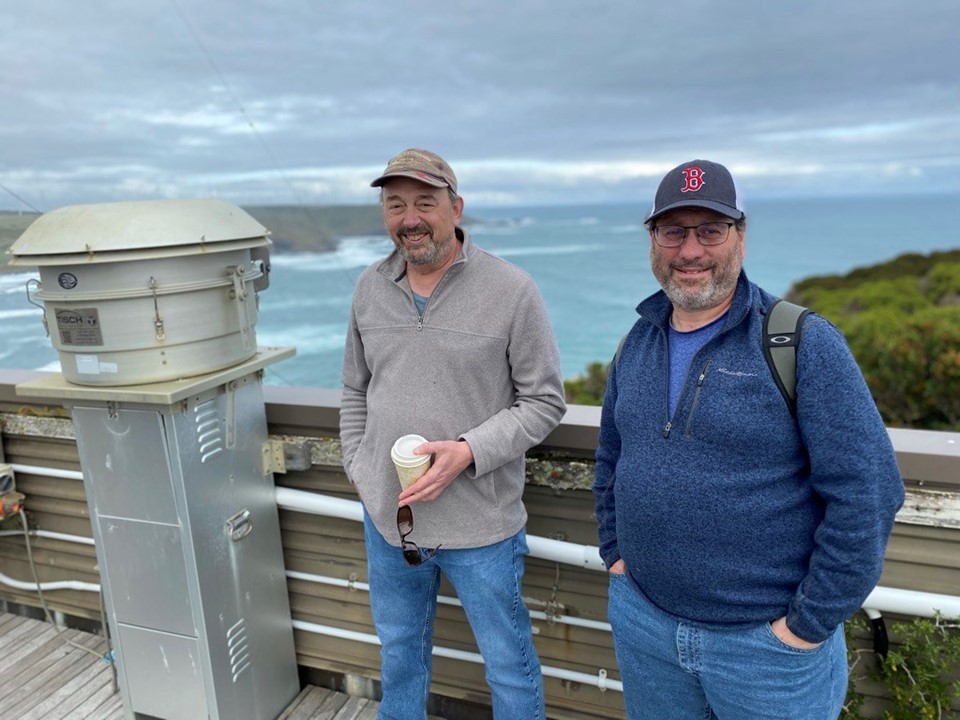
On April 23, the day after Earth Day, he boarded a plane for the 19-time-zone trip back to Hobart, the biggest city in Australia’s island state of Tasmania. From there, he made a six-hour car ride to kennaook/Cape Grim, a wind-scoured peninsula in the northwest.
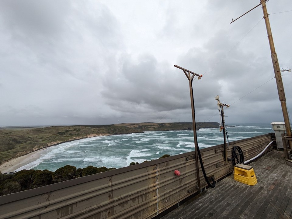
Up to 40% of the time, the air at this edge of the Southern Ocean is pristine enough to be a proxy for Earth’s pre-industrial age.
You could call Mace’s latest trip an Earth Day errand of sorts. He was on his way to the April 30 launch event for the Cloud And Precipitation Experiment at kennaook (CAPE-k), a field campaign that runs from April 2024 to September 2025.
A Hand from ASR
Mace and Roger Marchand, a research professor at the University of Washington, are CAPE-k’s co-principal investigators. They oversee teams collecting and analyzing measurements of some little-known atmospheric conditions and processes over the Southern Ocean.
“That’s what motivated us to propose CAPE-k… to tie all that together, to get all the seasons, and to take advantage of Australian data (collected) for decades now. It just felt like the right thing to do and the right time to do it.”
– Jay Mace
Their efforts are supported by the Atmospheric System Research (ASR) program at the U.S. Department of Energy (DOE). In a 2021–2024 project, Mace and others are investigating high-latitude aerosol-cloud interactions in the Southern Ocean. In a related 2018–2021 ASR project, Mace studied precipitation processes in the same region’s supercooled boundary-layer clouds.
CAPE-k is supported by the U.S. Department of Energy (DOE) with help from the Australian Bureau of Meteorology (BOM) and the Commonwealth Scientific and Industrial Research Organisation (CSIRO), Australia’s government agency for scientific research. CSIRO also operates Investigator, which will execute a complementary campaign to CAPE-k in May 2025.
CSIRO and BOM jointly manage the Kennaook/Cape Grim Baseline Air Pollution Station, where CAPE-k is sited and where CSIRO has collected continuous aerosol and trace gas measurements since 1976.
Core instruments for CAPE-k are part of a multi-container mobile observatory operated by DOE’s Atmospheric Radiation Measurement (ARM) user facility.
‘A Climate Shock Absorber’
The science mission of CAPE-k is linked to that rare pristine air. Scientists are interested in the low decks of open- and closed-cell stratocumulus clouds that arrive with such air and how their life cycles are linked to aerosols and precipitation. (Aerosols are tiny particles needed for cloud formation.)
With two full seasonal shifts ahead in its predicted duration of continuous measurements, CAPE-k will record the seasonality of these marine boundary-layer clouds in the Southern Ocean low clouds, their precipitation properties, and their effect on the radiative energy budget.
Mace calls the properties of these Southern Ocean boundary-layer clouds an emerging issue in how sensitive Earth’s climate is to global warming. CAPE-k data have the potential to improve global climate models.
Bear in mind that the Southern Ocean absorbs about half of Earth’s heat gain and soaks up 16% of its carbon dioxide emissions, details that make it a “climate shock absorber” for the world, according to the Australian Antarctic Program Partnership.
In many ways, says Mace, the Southern Ocean is slowing global climate change.
Origins of CAPE-k
The duration of CAPE-k, its multiple seasons, and its suite of U.S. and Australian instruments, says Mace, “ties together all the other investments made by DOE in the Southern Hemisphere.”
It was two of those investments that Mace and Marchand were studying in 2021, as part of an ASR project, that inspired CAPE-k.
“I’ve mostly focused on MARCUS,” says Mace, which stands for Measurements of Aerosols, Radiation, and Clouds over the Southern Ocean, a ship-based campaign funded by DOE and executed by ARM in 2017 and 2018.
“And Roger (Marchand) focused on MICRE,” he adds, referring to ARM’s land-based 2016–2018 Macquarie Island Cloud and Radiation Experiment.
In one study, led in 2023 by CSIRO researcher and CAPE-k co-investigator Ruhi Humphries, MICRE data were complemented by measurements from ACRE (the Antarctic Clouds and Radiation Experiment) from March 2016 to March 2018. ACRE was led by the Australian Antarctic Program Partnership, which also has a role in CAPE-k.
Two non-DOE field campaigns around the same time formed a necessary part of a constellation of Southern Ocean experiments.
“You go out in nature and paint what’s in front of you. You stand and study it… People say there’s art and there’s science. I don’t see a boundary.”
– Jay Mace on the way that both science and art demand observation
One was Australia’s two-phase CAPRICORN (Clouds Aerosols Precipitation Radiation and atmospheric Composition over the Southern Ocean), aboard Investigator in 2016 and 2018. Mace was on both voyages.
The other was a National Science Foundation-funded research aircraft effort in 2018 called SOCRATES (the Southern Ocean Clouds, Radiation, Aerosol Transport Experimental Study). Marchand was a co-investigator.
“We realized that we needed something to tie all that together,” says Mace of the inspirational ASR project and input from Marchand. “There were holes in all these data sets.”
Southern Ocean Papers
The “holes” in those data sets, says Mace, came from short-lived ship campaigns and instruments not doing well in remote and shipboard environments.
“That’s what motivated us to propose CAPE-k,” says Mace, “to tie all that together, to get all the seasons, and to take advantage of Australian data (collected) for decades now. It just felt like the right thing to do and the right time to do it.”
An overview of CAPRICORN, MARCUS, MICRE, and SOCRATES appeared in 2021. Mace led papers looking at CAPRICORN and MARCUS data (2020) and on CAPRICORN alone (2018).
Also in anticipation of CAPE-k, Mace led a 2023 paper on “natural” cloud brightening over the Southern Ocean, based on the concentration of cloud droplets in boundary-layer clouds influenced by biogenic (particles from biological processes) aerosol. It’s a topic the campaign will explicitly pursue further.
That paper used satellite data from NASA’s MODIS, or Moderate Resolution Imaging Spectroradiometer—a source of data-gathering that will persist during CAPE-k from MODIS, CloudSat (now retired), NASA’s CALIPSO (also retired), and other space-based data sources.
More Mace-led papers foreshadowed CAPE-k by using satellite measurements: one on snow in liquid Southern Ocean clouds (2021) and others on maritime storm tracks (2010) and supercooled low clouds (2020).
All the recent papers credited ASR for funding.
A Boy, a Tree, a Dream
Mace grew up in Southington, Ohio, the son of working-class parents he describes as progressive thinkers who were imbued with a sense of optimism.
“I picked that (optimism) up,” he says, as well as the determination to never work in an auto plant. His father did assembly line work. Many cousins and uncles, too.
Mace wanted a career that brought him close to nature. As a teenager, his habitual long hikes in the woods always included stopping by his favorite tree. It was a symbol of the peace and fascination he found in the outside world and the knowledge it offered.
Optimism, the woods, and an affinity for science “were a big part of forming the way I looked at the world,” he says.
But optimism is not the same as having enough money for college. Halfway through his senior year of high school, Mace decided to join the U.S. Navy.
“My plans had not changed,” he says. “I was going to escape one way or the other. My ticket out was through the military.”
After basic training, only one Navy specialty resonated with Mace’s inclination toward the natural sciences: meteorology.
“They needed weather people,” he says, though he turned down an offer to be a nuclear engineer instead. “I’m an atmospheric scientist largely because I didn’t want to live in a submarine or in the bottom of some ship. I wanted to be able to see the sky.”
Getting to College
The military was his ticket out of Ohio. It was also Mace’s ticket into college.
In 1987, fresh off active duty, he entered Ohio University (B.S., meteorology, 1989). Credits earned in the Navy shortened his summa cum laude undergraduate work by two years. He was married with a family (his son turns 40 this year), and he admits it was a financial struggle.
“Once I realized I could get paid to go to graduate school (through the Navy),” says Mace, “I thought, ‘This might be what I am going to do.’”
There was another reason to pursue graduate studies, he says. “I didn’t want to stop (schooling), and I didn’t want to be a forecaster. I wasn’t very good at it.”
At Penn State (PhD, atmospheric physics, 1994), Mace joined the doctoral program after a year of graduate coursework. He studied with Bruce Albrecht, now a University of Miami professor emeritus, and with Thomas P. “Tom” Ackerman, now a University of Washington professor emeritus.
Under Ackerman’s direction, Mace wrote his dissertation on the vertical motions that produce cirrus clouds. These wispy, icy, high-altitude clouds significantly influence the Earth’s energy budget.
Albrecht and Ackerman were heavy players and planners in the early days of ARM. Ackerman took Mace along to install the first cloud radar at ARM’s Southern Great Plains (SGP) atmospheric observatory in Oklahoma.
Introduction to ARM
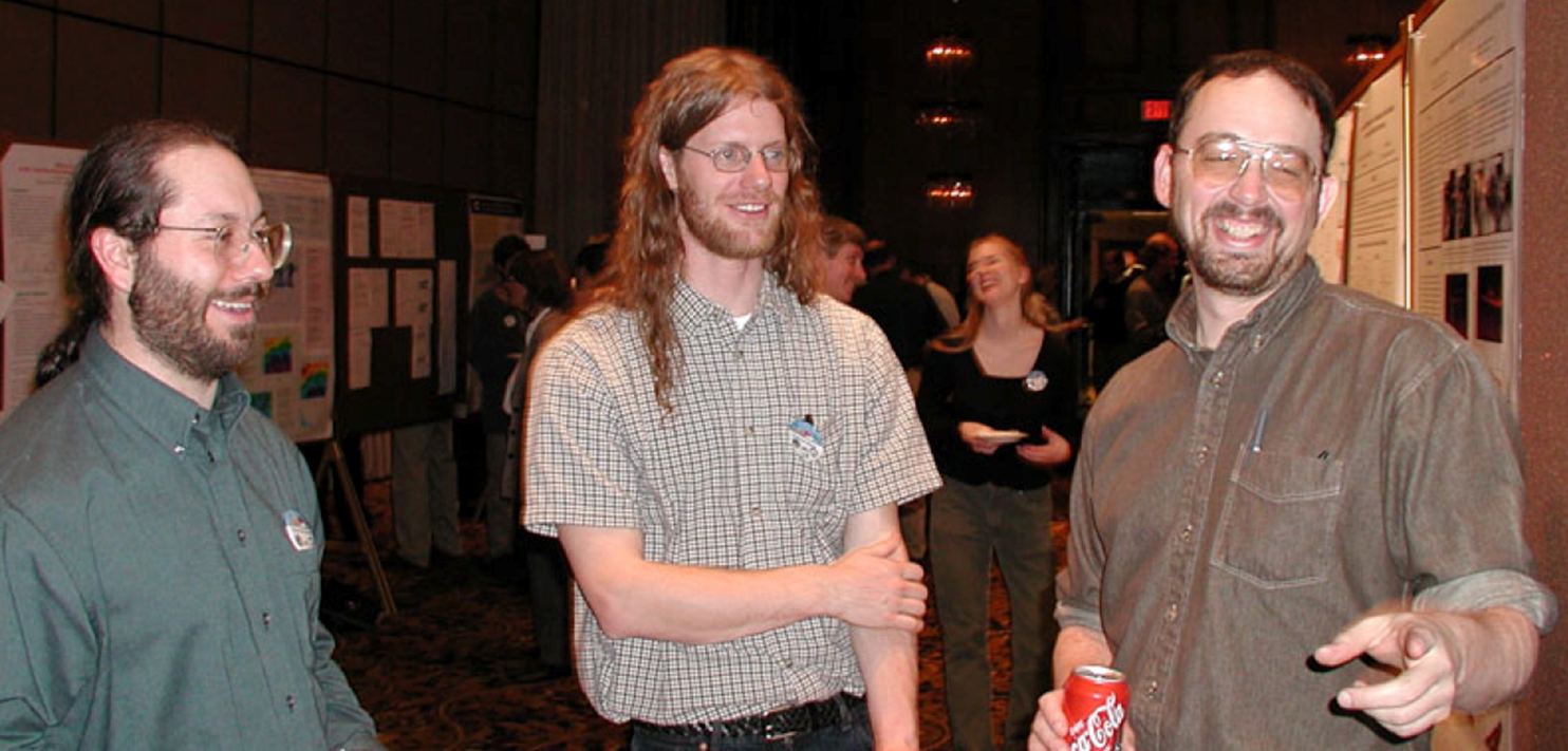
At the time Mace was immersed in doctoral work, Penn State swarmed with other future key figures in the then-nascent world of ARM. Jim Mather, ARM’s current director, was his officemate. When Mace left for Utah, Marchand—his CAPE-k partner—took his place as a postdoctoral researcher at Penn State.
Mace also shared an office with atmospheric modeler Andrew Vogelmann, who recently retired from Brookhaven National Laboratory in New York. Rutgers University cloud and climate researcher Mark Miller was Albrecht’s student then. Longtime ARM scientist Chuck Long (now deceased) was Ackerman’s student. Current Penn State professor Eugene Clothiaux and professor emeritus Johannes Verlinde were also there and, in the years that followed, played significant roles in ARM.
Mace’s first campaign was an early one with ARM──FIRE II Cirrus in 1991 in Coffeyville, Kansas. It was one of four intensive field campaigns collectively known as the First ISCCP Regional Experiment (FIRE), which began in 1984. The FIRE series was the NASA-run U.S. contribution to the International Satellite Cloud Climatology Project (ISCCP), intended to provide the first systematic picture of global cloud behavior.
ARM took part to gain operational experience for its own future field deployments. ARM did not officially begin collecting data until 1992 at the SGP.
“All the people who started the ARM program were involved in this,” says Mace of FIRE II. “We were there at the ground floor.”
Throughout the 1990s, Mace participated in many ARM campaigns, work that “taught us all how to do this kind of thing.”
Early Campaign Interludes
In December 1996, Mace took a tenure-track position at the University of Utah, where he has been now for close to 30 years.
Fieldwork was part of the job, and Mace kept close to ARM. In fall 1997, he led a 20-day intensive operational period at the SGP. It was a coordinated mix of six small research efforts on water vapor, clouds, aerosols, shortwave radiation, a single-column model, and what ARM now refers to as an uncrewed aerial system.
Spring cloud intensive operational periods followed in 1998 and 2000 at the SGP, with Mace leading both. The 2000 study deployed remote sensors, including radars and lidars, to record the first three-dimensional cloud field derived from observational data.
Over the next decade, Mace participated in campaigns in Florida, Texas, Australia, Georgia (the U.S. state), and Costa Rica, though ARM did not conduct all of them.
Mace returned to the SGP in the first half of 2010 to lead the Small Particles in Cirrus (SPARTICUS) campaign. He tapped remote sensing data going back to the early 1990s to improve how global climate models represented cirrus clouds.
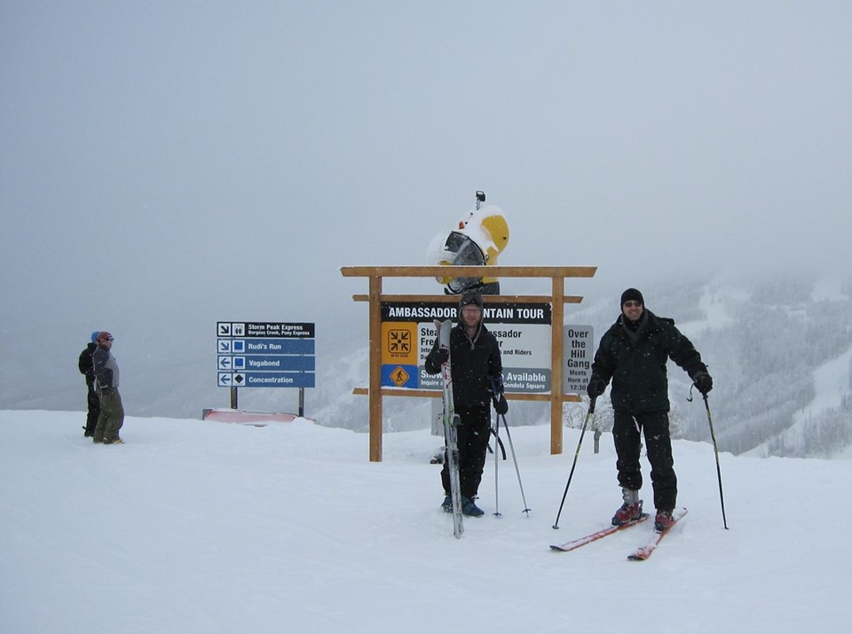
A STORMVEX Adventure
During the winter of 2010─2011, Mace led ARM’s Storm Peak Lab Cloud Property Validation Experiment (STORMVEX) in Steamboat Springs, Colorado.
The STORMVEX plan was to use four observation sites to capture a comprehensive picture of cloud and aerosol properties from below and within clouds that snowed.
“I was just looking at the data last night and thinking, ‘God, man, there’s just beautiful, beautiful data,’” he says.
However, STORMVEX deployed only one radar frequency, W-band, which is not the best one for studying snow.
“You need at least two frequencies,” he says, “and ideally three.”
In the winter of 2024─2025, Mace will be part of the Snow Sensitivity to Clouds in a Mountain Environment (S2nowClime) campaign, funded by the National Science Foundation. The campaign could pass as a remake of STORMVEX—this time with three radar frequencies.
In April 2024, Mace and others scouted candidate instrument sites in Colorado.
One upside, Mace says, is that the new campaign “might teach us how to analyze the STORMVEX data.”
In the Open Air
In his adult life, Mace maintained his childhood passion for hiking and the great outdoors. He has struck out into the wilderness through Grand Teton, Yellowstone, and other national parks. He and his wife own a cabin in Idaho at the edge of the wilderness.
Hiking in wild places “is why I came West, ultimately,” he says, “and that’s why I stayed out here.”
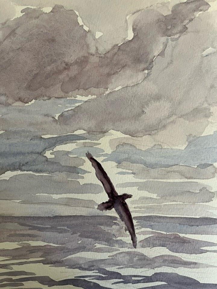
The science Mace is doing in the Southern Ocean fits with being a landscape painter, complete with representation by a gallery in Idaho. It’s an avocation that took the place of photography close to 20 years ago.
“As much as my science is part of me, doing art is part of me,” says Mace, who adopted the en plein air approach. (In French, that means “in the open air.”)
“You go out in nature and paint what’s in front of you. You stand and study it,” he says, the same way science demands observation. “People say there’s art and there’s science. I don’t see a boundary.”
The idea of art and science as complementary practices takes Mace back to his foundational experiences with nature in the woods of northeastern Ohio.
“As a teenager, I made a promise to myself to stay true to that kind of thing,” he says. “My 14-year-old self would recognize my 62-year-old self.”
# # #Author: Corydon Ireland, Staff Writer, Pacific Northwest National Laboratory
This work was supported by the U.S. Department of Energy’s Office of Science, through the Biological and Environmental Research program as part of the Atmospheric System Research program.